National Historic Site of Canada
Hamilton and Scourge National Historic Site of Canada
Lake Ontario, Ontario
Also known as Hamilton and Scourge, Hamilton et Scourge
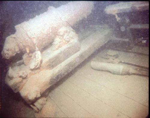
Underwater image of the cannon on the Hamilton and Scourge wreck, 1982.
Photo: National Geographic, 82-1874, 1982.
- Recognized
- 1976
- By
- Government of Canada
The register’s text, word for word
Description
Hamilton and Scourge National Historic Site of Canada is located at the bottom of Lake Ontario 11 kilometres north of Port Dalhousie, near St. Catharines. The site is comprised of the wrecks of two American gunships, the Hamilton and the Scourge, which sank during the War of 1812. The ships are in a remarkably good condition, despite their initial sinking and despite some decay brought about by the passage of years at lake bottom. A sizeable debris field surrounds the two wrecks, and it is thought that the site contains numerous artifacts. The official recognition refers to a perimeter around the two shipwrecks in their existing spatial relationships.
Heritage value
Hamilton and Scourge was designated a national historic site of Canada in 1976 because:
- they are rare examples of vessels of the War of 1812, of any type, that have survived to this day, and are in remarkable condition, and contain a vast historical treasure of shipboard articles.
The Hamilton and the Scourge were originally constructed as merchant schooners, but both were pressed into service by the Americans and modified for military purposes at the outbreak of the War of 1812. On the night of August 7-8, 1813, a sudden squall came over the American fleet stationed off Port Dalhousie, causing both ships to capsize and sink. Less than a quarter of the over 70 crew members aboard both vessels, survived. The loss of life was the greatest single loss of life on the Great Lakes during the entire war. The wrecks were discovered in their current location in 1979 and were purchased from the United States Government by the City of Hamilton. They have been the subject of several underwater archaeological investigations.
SourceHistoric Sites and Monuments Board of Canada, Minutes, October 2006.
Character‑defining elements
Key elements contributing to the heritage value of this site include:
- the location of the ships at the bottom of Lake Ontario 11 kilometres north of Port Dalhousie;
- the underwater archaeological remains of the two ships in their current condition and location, including the hull, fragments of the vessel and the surrounding debris field;
- the integrity of any surviving or as yet unidentified archaeological remains associated with the wreck, which may be found within the site in their original placement and extent, including all remains of a naval, military and personal nature.
End of the register’s text
Location
Lake Ontario, Ontario, Canada
43.30850° N, 79.30972° W
Get directions (opens in a new tab)Being on the register doesn’t make a place open to visitors. Many are private homes or businesses; please view them from the street.

Loading map…
Nearby
 Former Lighthouse Keeper's Dwelling11 km · St. Catharines · 1931
 Front Range Lighthouse12 km · Port Dalhousie · 1879
 Rear Range Lighttower12 km · Port Dalhousie · 1898
 Port Dalhousie Heritage Conservation District12 km · Port Dalhousie
 Salem Chapel, British Methodist Episcopal Church National Historic Site of Canada17 km · St. Catharines · 1851
 Armoury17 km · St. Catharines · 1905
Similar places
Places whose register descriptions are closest to this one.
 Battle of Stoney Creek National Historic Site of CanadaHamilton, Ontario
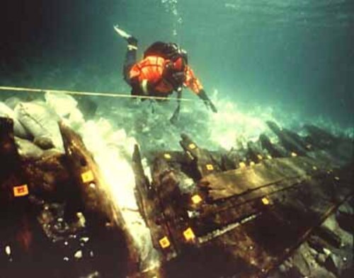 Wreck of the Elizabeth and Mary National Historic Site of CanadaBaie-Trinité, Quebec
 Burlington Heights National Historic Site of CanadaHamilton, Ontario
 Corossol National Historic Site of CanadaSept-Îles, Quebec
 Battlefield of Fort George National Historic Site of CanadaNiagara-on-the-Lake, Ontario
 Battle of Beaver Dams National Historic Site of CanadaThorold, Ontario
From the Canadian Register of Historic Places, as last updated on December 12, 2025. The register’s text is shown word for word.