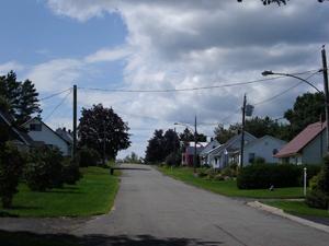
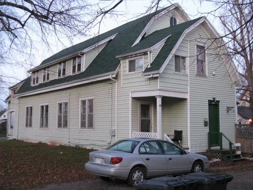
Overview of the streetscape
Photo: Carleton County Historical Society
- Built
- 1948
- Recognized
- 2006
- By
- Local government
The register’s text, word for word
Description
Cambridge Street is a quiet cul-de-sac branching off Grover Street, located within easy walking distance of Woodstock’s downtown. The street is known for its rows of war-time houses situated on spacious lots along both sides of the street.
Heritage value
Cambridge Street is designated a Local Historic Place for being a good example of the war-time housing neighbourhoods that were built by Wartime Housing Limited in towns across Canada in the years shortly after World War II.
Cambridge Street’s single and one-and-a-half-storey war houses are a selection of approximately 28 of the 50 that were constructed in Woodstock in 1948, the remainder being built on the adjacent streets. These groups of simple bungalows were designed as temporary housing, yet became lasting neighbourhoods. Cambridge Street is unique in that despite some minor alterations, the majority of homes have maintained a high degree of integrity. The overall design of these homes includes gable roofs, rectangular massing and very little decoration. The placement of the houses on the street and within their own lots creates a unique uniformity in the spacial arrangement of the neighbourhood. Property lines have remained largely the same, including several shared driveways.
SourceCarleton County Historical Society Historic Places Files, “Cambridge Street”
Character‑defining elements
The character-defining elements that describe Cambridge Street include:
- proximity to downtown amenities;
- cul-de-sac ensuring low traffic;
- large lots;
- some shared driveways;
- approximately 28 rectangular single-storey and one-and-a-half-storey war-time houses with gable roofs, built to the Wartime Housing Limited specifications;
- spatial configuration of homes within the grouping;
- consistent setback of homes from the street.
End of the register’s text
Location
Cambridge Street, Woodstock, New Brunswick, E7M, Canada
46.15801° N, 67.57588° W
Get directions (opens in a new tab)Being on the register doesn’t make a place open to visitors. Many are private homes or businesses; please view them from the street.

Loading map…
Similar places
Places whose register descriptions are closest to this one.
From the Canadian Register of Historic Places, as last updated on December 12, 2025. The register’s text is shown word for word.