National Historic Site of Canada
St. Andrews Caméré Curtain Bridge Dam National Historic Site of Canada
Lockport, Manitoba
Also known as St. Andrews Caméré Curtain Bridge Dam, Pont-barrage à rideaux Caméré St. Andrews
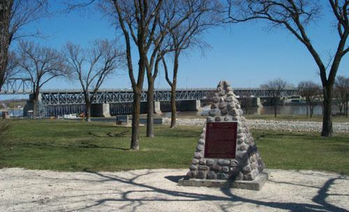
In background, the St. Andrews Caméré Curtain Bridge Dam National Historic Site of Canada, 2004.
Photo: Parks Canada Agency / Agence Parcs Canada, 2004.
- Built
- 1907–1910
- Recognized
- 1990
- By
- Government of Canada
The register’s text, word for word
Description
St. Andrews Caméré Curtain Bridge Dam is a 270 metre-long bridge-dam spanning the Red River at Lockport, Manitoba. The bridge supports a movable dam consisting of a series of Caméré curtains which maintain the river at a navigable depth during the summer months and are rolled up and removed each fall to enable the spring flood waters to pass unimpeded under the bridge. A canal lock, constructed in the west bank adjacent to the bridge-dam, carries river traffic past the dam. Today the bridge-dam remains in service on provincial Highway #44.
Heritage value
St. Andrews Caméré Curtain Bridge Dam was designated a national historic site of Canada because this engineering work is perhaps the only surviving moveable dam of its type in the world.
The heritage value of this site is carried in the design and materials of the structure itself. Erected by the Federal Department of Public works between 1907 and 1910, it is the largest of its type ever constructed. In 1912-1913, approach spans were added and a roadway built across the bridge-dam. The approaches were modified and loading capacity increased in 1947-1949. New frame and curtain cranes replaced the originals in 1967. By that time railway and road transport had largely replaced water transport, severely reducing the commercial use of the river and canal system.
SourceHistoric Sites and Monuments Board of Canada, Minutes, November 1990.
Character‑defining elements
Key elements of this structure include:
- the location over former rapids in the Red River;
- the current 240.1-metres length between abutments;
- the dam design as a movable weir;
- its division into six 36.3-metres, 0.2 metre-wide bays by five concrete piers interconnected at their base;
- the original 270-metres long bridge superstructure consisting of 7 truss spans and a deck truss with upper chords carrying a road and lower chords supporting a suspended floor and a working floor for the curtain dam;
- the electrically powered frame cranes running on a trolley track along the working floor to raise and lower the hinged curtain frames and smaller curtain cranes mounted on a truck on tracks;
- the steel shoes set into the submerged dam serving as a sill for the movable component;
- 90 wooden curtains hooked onto the curtain frames;
- the concrete lock and dam substructure;
- the solid timber mitre gates;
- the steel Pratt bridge trusses;
- the concrete and steel Strauss bascule bridge;
- the existence of a vehicular road-deck.
End of the register’s text
Location
St. Andrews Rapids, Red River / Highway #44, Lockport, Manitoba, R1A, Canada
50.08306° N, 96.94444° W
Get directions (opens in a new tab)Being on the register doesn’t make a place open to visitors. Many are private homes or businesses; please view them from the street.

Loading map…
Nearby
 Firth House850 m · St. Andrews · 1861
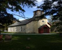 Little Britain United Church2.2 km · St. Andrews · 1872
 Captain William Kennedy House2.6 km · St. Andrews · 1866
 St. Andrew's on the Red Anglican Church2.9 km · St. Andrews · 1845
 Miss Davis' School Residence / Twin Oaks National Historic Site of Canada2.9 km · St. Andrews
 St. Andrew's Anglican Church National Historic Site of Canada2.9 km · St. Andrews · 1845
Similar places
Places whose register descriptions are closest to this one.
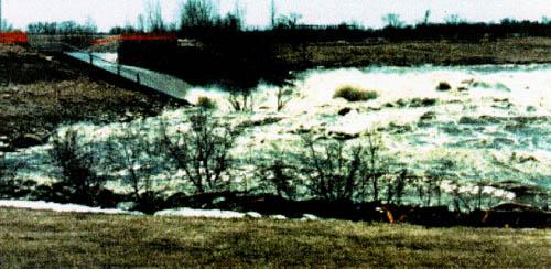 Red River Floodway National Historic Site of CanadaWinnipeg, Manitoba
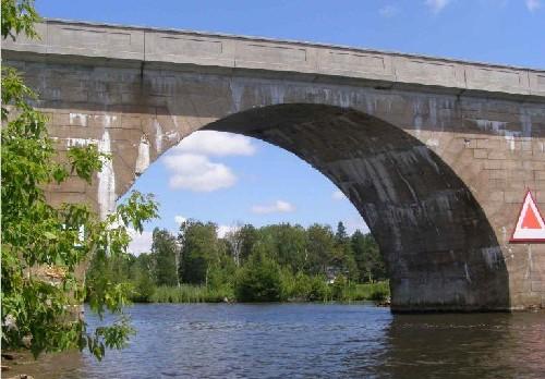 Canal Lake Concrete Arch Bridge National Historic Site of CanadaKawartha Lakes, Ontario
 Stave Falls Hydro-Electric Installation National Historic Site of CanadaMission, British Columbia
 The Forks National Historic Site of CanadaWinnipeg, Manitoba
 Trent – Severn Waterway National Historic Site of CanadaTrenton / Port Severn, Ontario
 Peterborough Lift Lock National Historic Site of CanadaPeterborough, Ontario
From the Canadian Register of Historic Places, as last updated on December 12, 2025. The register’s text is shown word for word.