National Historic Site of Canada
Fort Norfolk National Historic Site of Canada
Norfolk, Ontario
Also known as Fort Norfolk, Turkey Point
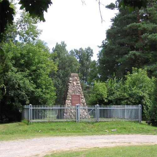
General view of the Historic Sites and Monuments Board of Canada plaque and cairn, 2005.
Photo: Parks Canada Agency/Agence parcs Canada, 2005.
- Built
- 1814–1815
- Recognized
- 1925
- By
- Government of Canada
The register’s text, word for word
Description
Fort Norfolk National Historic Site of Canada is located at the entrance to Turkey Point Provincial Park golf course, bounded by the eastern edge of Old Hill Road, near Lake Erie. The site consists of mixed landscape features and foliage, and is surrounded by the vast lawns of the nearby golf course. There are no known extant remains of Fort Norfolk; however, since its designation the site has been the subject of several archival research projects. Official recognition refers to the polygon of land bounded by the eastern edge of Old Hill Road in Turkey Point, Ontario.
Heritage value
Fort Norfolk was designated a national historic site of Canada in 1925 because:
- it was the site of a British military and naval post between 1814 and 1815. [Minutes / Plaque Text, 1926]
In 1795, Lieutenant-Governor John Graves Simcoe selected the Turkey Point area for the construction of a fort and naval station. During the War of 1812, the area became of strategic interest to the British, who on the orders of General Henry Procter, built a blockhouse and a partial palisade on the slope above Turkey Point. From 1814 until 1815, Fort Norfolk served as a British military and naval post, but when hostilities ceased, the project was abandoned. By 1826, the fort was in such a state of decay that the naval and military developments were relocated northeast to the Grand River.
SourceHistoric Sites and Monuments Board of Canada, Minutes, 1925; 1926; December 2009.
Character‑defining elements
Key elements that contribute to the heritage character of the site include:
- its strategic location on a bluff bordered by two ravines just east of Old Hill Road, which descends to Turkey Point;
- its setting amongst the wooded landscape, surrounded by the lush rolling lawns;
- the integrity of any surviving or as yet unidentified archaeological resources associated with the War of 1812, which maybe found within the site in their original placement and extent, including trenches;
- the integrity of any surviving or as yet unidentified archaeological resources associated with British naval and military posts, which maybe found within the site in their original placement and extent, including remnants of a palisade and blockhouse.
- viewscapes from the site, south on Lake Erie.
End of the register’s text
Location
Norfolk, Ontario, Canada
42.69891° N, 80.32524° W
Get directions (opens in a new tab)Being on the register doesn’t make a place open to visitors. Many are private homes or businesses; please view them from the street.

Loading map…
Nearby
All 4 places in Norfolk Van Norman-Guiler House1.7 km · Normandale
 Port Dover West Pier Lighthouse14 km · Port Dover · 1850
 Lighthouse14 km · Port Dover
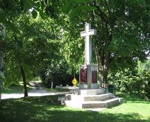 Cliff Site National Historic Site of Canada14 km
 Backhouse Grist Mill National Historic Site of Canada15 km · 1798
 Lynnwood/Campbell-Reid House National Historic Site of Canada16 km · 1850
Similar places
Places whose register descriptions are closest to this one.
 Fort Erie National Historic Site of CanadaFort Erie, Ontario
 Fort George National Historic Site of CanadaNiagara-on-the-Lake, Ontario
 Fort Drummond National Historic Site of CanadaNiagara-on-the-Lake, Ontario
 Norway House National Historic Site of CanadaNorway House, Manitoba
 Fort Henry National Historic Site of CanadaKingston, Ontario
 Fort Townshend National Historic Site of CanadaSt. John's, Newfoundland And Labrador
From the Canadian Register of Historic Places, as last updated on December 12, 2025. The register’s text is shown word for word.