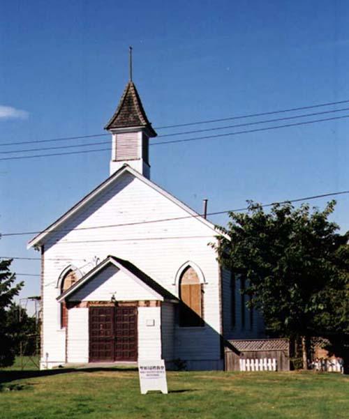
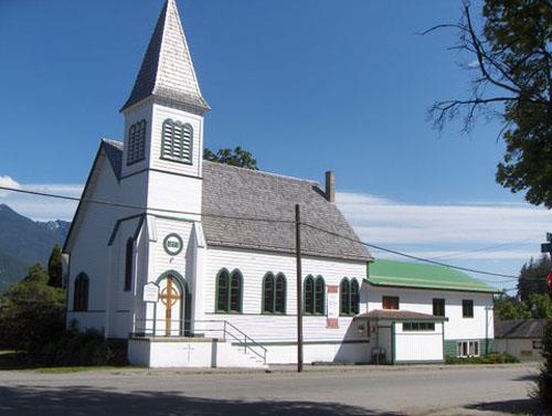
Photo: Denise Cook Design, 2004.
- Construction
- 1906
- Reconnaissance
- 1991
- Par
- Administrations locales (C.-B.)
Le texte du répertoire, mot pour mot
Description
The South Arm Presbyterian Church is a small, rectangular church building with a gable roof and tower, situated on a prominent corner lot. The historic place is confined to the footprint of the building.
Valeur patrimoniale
An important landmark in the Gilmore area of Richmond, the South Arm Presbyterian Church has an historical association to the development of the South Arm community in Richmond, and to many of its prominent pioneers, including Thomas Kidd, Archibald Blair and Charles London, who were involved in its construction and made up its congregation. Replacing the early church services held at London's Landing, the church was built at the intersection of No. 3 Road and Steveston Highway, away from the river front, at a time when newly constructed roads were giving people more access to and movement through the centre of Lulu Island and communities were growing.
Originally located prominently on the corner of its present site, the design of the church is simple, a fine example of early country church architecture, and representative of the efforts of local citizens to build their own community church in the South Arm. Its closure in 1925 after the amalgamation of churches in Richmond is representative of the history of churches in Richmond.
SourceCity of Richmond Clerk's Department File #4200-02
Éléments caractéristiques
Character defining elements of the South Arm Presbyterian Church include:
- Its landmark location at a prominent intersection and its relationship to the site and the street
- Its simple church form, consisting of a rectangular plan with a front gable roof and a gable roofed porch on the east façade
- The square tower located towards the front of the church, with its four sided, bell-cast roof and finial
- Exterior details including wooden drop-siding and the remaining windows which are wooden sash gothic arched windows with coloured leaded glass
Fin du texte du répertoire
Emplacement
49.13280° N, 123.13797° W
Itinéraire (s’ouvre dans un nouvel onglet)L’inscription au répertoire ne rend pas un lieu accessible au public. Beaucoup sont des résidences ou des commerces privés; admirez-les depuis la rue.

Chargement de la carte…
À proximité
Les 35 lieux de Richmond
Lieux semblables
Les lieux dont la description du répertoire se rapproche le plus de celle-ci.
 Minoru ChapelRichmond, Colombie Britannique
 Old St. Andrew's Presbyterian ChurchNew Westminster, Colombie Britannique
 St. Andrew's Presbyterian ChurchMaple Ridge, Colombie Britannique
 Richmond Rod and Gun ClubRichmond, Colombie Britannique
 St. Andrew's Presbyterian Church, SandwickCourtenay, Colombie Britannique
 St. Andrew's United ChurchKaslo, Colombie Britannique
Tiré du Répertoire canadien des lieux patrimoniaux, dans sa dernière mise à jour du 12 décembre 2025. Le texte du répertoire est reproduit mot pour mot.