Fort St. Pierre National Historic Site of Canada
Also known as: Fort St. Pierre National Historic Site of Canada, Fort St. Pierre, Fort St.-Pierre
Description
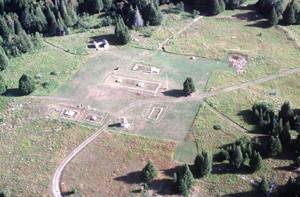
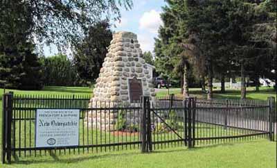
Fort St. Pierre National Historic Site of Canada is located in the town of Fort Frances, 348 km west of Thunder Bay, Ontario. The site comprises an open grassed area in Pither’s Point a municipal park on a point of land at the southwest end of Rainy Lake at the mouth of the Rainy River. Constructed in 1731, there are no extant remains of the square fort, which measured 50 feet on each side, and featured two gates surrounded by a double row of thirteen feet high stakes. A seven feet wide road surrounded the fort’s two main buildings, each of which featured two rooms with double chimneys. On either side of Fort St. Pierre were two bastions one of which contained a storehouse and powder magazine.
Heritage Value
Fort St. Pierre was designated as a national historic site of Canada in 1934 because:
- it served as a trading post and a base for La Vérendrye’s westward explorations from 1731-1758, in search of the hypothetical “western sea” (la mer de l’Ouest).
In 1731, French explorer La Vérendrye left Montreal with 50 men, including his eldest son and his nephew, Sieur de La Jemeraye, and travelled west. While La Vérendrye wintered at Kaministiquia, Sieur de La Jemeraye constructed Fort St. Pierre on the southwest end of Rainy Lake. It was the second French fort to be constructed on Rainy Lake having been preceded by Zacharie Robutel de La Noue’s Fort Tekamanigan, built in 1717 and vacated in 1721. Fort St. Pierre was built for the purpose of participating in the western fur trade north of Lake Superior and furthering La Verendrye’s explorations in search of the hypothetical “western sea” that was believed would provide a route to the Far East. The French vacated Fort St. Pierre in 1758 during the Seven Year’s War.
Character-Defining Elements
Key elements contributing to the heritage value of this site include: - its location in the town of Fort Frances at the southwest end of Rainy Lake near the mouth of the Rainy River; - its strategic location in the region where several other fur trading forts were constructed during the eighteenth and nineteenth centuries; - its setting in a flat grassy area within a treed park overlooking the Rainy River and Rainy Lake; - the integrity of any surviving or as yet unidentified archaeological remains relating to the fort’s period of occupation between 1731-1958, which may be found within the site in their original placement and extent; - the viewscapes between the site and its surrounding landscape.
Gallery
2 imagesLocation
Loading map...
Similar Places
Heritage sites with similar characteristics