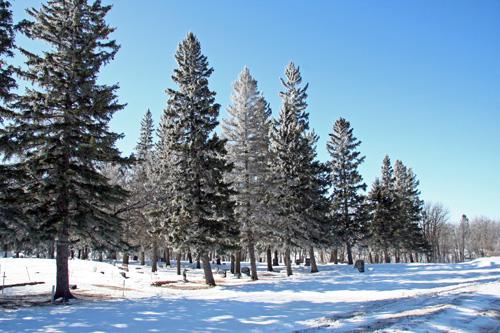
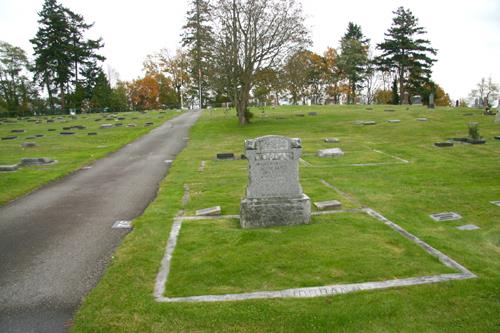
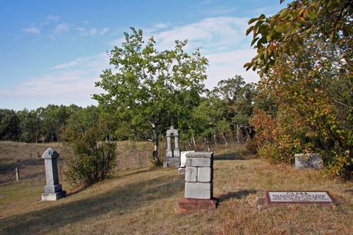
Contextual view, from the northeast, of Dominion City Cemetery, Dominion City, 2007
Photo: Historic Resources Branch, Manitoba Culture, Heritage, Tourism and Sport, 2007
- Recognized
- 2006
- By
- Local government
The register’s text, word for word
Description
The Dominion City Cemetery, a large rectangular burial ground on the eastern edge of Dominion City, is bounded on the south and west by a small tributary of the Roseau River, on the north by plantings of evergreen trees and on the east by oak trees. The municipal designation applies to the 5,625-square-metre parcel of land.
Heritage value
The Dominion City Cemetery, a spacious, formally organized burial ground, presently containing more than 100 graves, serves as Dominion City's only cemetery. As the final resting place for many of the pioneers who settled in the area beginning in ca. 1890, it tells the story of the community's past through the names and inscriptions on the grave markers. The cemetery's picturesque site (on land donated by St. Paul's Lutheran Church) at the edge of the urban area is a typical location for an important community amenity, providing a restful place of solace.
SourceRural Municipality of Franklin By-law No. 13-06, August 8, 2006
Character‑defining elements
Key elements that define the site character of the Dominion City Cemetery include:
- the location on the east bank of a tributary of the Roseau River at the eastern edge of Dominion City
- the formal layout, including rows of tree plantings along two perimeters and the north and east driveways and the orderly arrangement of gravesites in tidy rows
Key elements that define the cemetery's heritage character and memorial function include:
- the burials, including their east-facing orientation
- the variety of headstones with engravings
- the granite boulder with attached polished granite tablet bearing the cemetery's name and a commemoration recalling area pioneers
- the public access and continuing use
End of the register’s text
Location
Franklin, Manitoba, R0A, Canada
49.14294° N, 97.14619° W
Get directions (opens in a new tab)Being on the register doesn’t make a place open to visitors. Many are private homes or businesses; please view them from the street.

Loading map…
Nearby
All 9 places in Franklin
Similar places
Places whose register descriptions are closest to this one.
From the Canadian Register of Historic Places, as last updated on December 12, 2025. The register’s text is shown word for word.