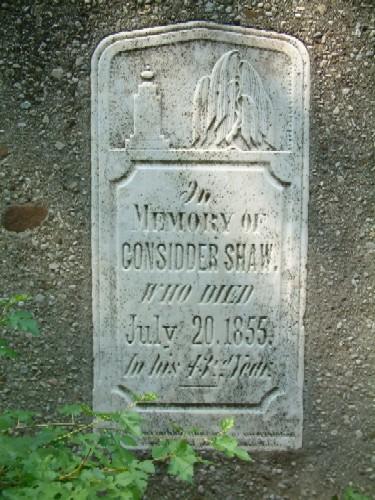
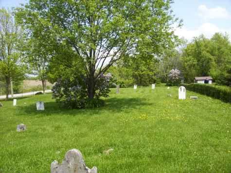
Close-up of the monuments of the Upper Farm Cemetery
Photo: Haldimand County
- Recognized
- 1982
- By
- Local government
The register’s text, word for word
Description
Upper Farm Cemetery is on George Upper's, ca. 1837, farm which is located outside of Townsend, Ontario, at 863 Keith Richardson Parkway, in Haldimand County.
The former City of Nanticoke, now Haldimand County, designated the site for its heritage value, under Part IV of the Ontario Heritage Act, By-law 62-82.
Heritage value
George Upper, descended from a family of Pennsylvania Loyalists, and came to Haldimand County in 1837 where he farmed and operated a sawmill. He purchased all of Lot 24, Concession 13, where a schoolhouse came to be located. The schoolhouse doubled as a church for Sunday services and a half-acre became allocated to the cemetery. The cemetery is now incorporated into the area's park system. The cemetery typifies rural nineteenth century Ontario graveyards. Twenty-one granite and marble markers have survived the passage of time, ranging in date from 1845 to 1873.
The gravestones represent a particular type of Ontario funerary art, when tombstones were individually crafted objects of pleasing form and decoration. These stones date from 1790-1900 and most are soft, marble bearing carved motifs and touching epitaphs. The oldest surviving stone is dated January 9, 1845 for Gereetia, wife of Joel Davis. The most recent stone is that of Ann Eliza Wilkin, dated June 4, 1873 and reads:
“AE 2 Y's, 10 M's. and 11 D's
Sleep gentle child this peaceful rest'
Hath early given thee a home above.”
SourceFormer City of Nanticoke, now Haldimand County, By-law 62-82.
Character‑defining elements
Character defining elements that reflect the heritage value of the Upper Farm Cemetery include its:
- location on a rural farmstead
- interesting and eclectic collection of 21 well preserved tombstones and footstones
- location within the current park system
End of the register’s text
Location
863, Keith Richardson Parkway, Haldimand County, Ontario, N0A, Canada
42.89374° N, 80.14135° W
Get directions (opens in a new tab)Being on the register doesn’t make a place open to visitors. Many are private homes or businesses; please view them from the street.

Loading map…

Similar places
Places whose register descriptions are closest to this one.
From the Canadian Register of Historic Places, as last updated on December 12, 2025. The register’s text is shown word for word.