Municipal Heritage Building, Structure or Land
The Herder Property Municipal Heritage Site
Conception Bay South, Newfoundland and Labrador
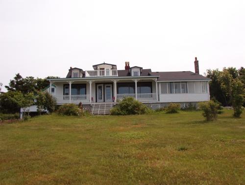
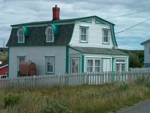
Herder Property, 138 Cherry Lane, Manuels, Conception Bay, view from ocean side, formerly the rear of the property, 2004
Photo: Heritage Foundation of Newfoundland and Labrador, 2004
- Built
- 1932
- Recognized
- 2003
- By
- NL Municipality
The register’s text, word for word
Description
The Herder Property is a large expanse of land on which there is a one-and-one-half-storey house, two outbuildings and various rock walls. The property is located at 138 Cherry Lane, Manuels, Conception Bay South. The designation encompasses the entire property.
Heritage value
The Herder Property was designated by the Town of Conception Bay South because it has historical, cultural, aesthetic and environmental values.
The Herder Property has historical value because it was built in 1932 for William James Herder, founder of "The Evening Telegram" newspaper. After an apprenticeship with the weekly newspaper "The Courier" Herder bought the paper in 1879. He published the first edition of The Evening Telegram on April 3 of that year from his Duckworth Street, St. John’s press. Within one year demand for the daily newspaper increased from 400 four-page newspapers to over 2000 eight-page newspapers. Today the paper is run under the name "The Telegram" and is the oldest continuously published daily in the province.
The Herder Property also has historic value because the original kitchen in the house had a well under the floor. This well was later replaced by what is believed to be one of the first artesian wells in Newfoundland. The nearby residents used the well on the property to get water. It runs directly to the beach in an area known as “pump meadow” and the residents brought barrels by horse and cart to access the water when their own wells dried up.
Although the Herder Property has been through substantial alterations it still has aesthetic value. It has had several owners and was winterized so that it could be used as a year round residence. The original roofline can still be seen and the house still retains many of its original features. The house has a steep gable roof and narrow clapboard. Other notable features include dormer peaked windows, a widow’s walk, two end chimneys, a small triangular window in the side gable peak and an enclosed sunroom at the front of the house.
Also located at the rear of the property (once the front) are a low-pitched gable roof carriage house and a mid-pitched gable roof pump house, which are still in good condition. The rectangular wood plank doors lack decoration, which is a feature of the functionality of these buildings. The property has two road entrances and both the carriage house and a barn are located at the top of the property, at what was the front of the house. The fact that visitors to the property could drive right into the carriage house speaks to the social status of the family at the time.
The Herder property has environmental value because it is surrounded by rock walls and flagstones that were transported over from Little Bell Island. It also is completely surrounded by a white picket fence. The property contains a variety of trees and shrubs and boasts a magnificent view of the ocean from Kelligrews to St. Philips.
SourceTown of Conception Bay South Regular Council Meeting Motion #03-541 November 4, 2003.
Character‑defining elements
All those original elements of the house, surrounding property and outbuildings, including:
-one-and-one-half-storey house;
-wooden construction;
-wooden clapboard;
-steep pitch gable roof on house;
-low pitch gable roof on carriage house;
-mid pitch gable roof on pump house;
-dormer windows with peaked roofs;
-widow’s walk;
-end chimneys;
-small triangular window in gable;
-sunroom;
-carriage house;
-pump house;
-rock walls and flagstones;
-mature treed lot with greenspace;
-uninhibited view of ocean from house; and -location, orientation and dimensions.
End of the register’s text
Location
Conception Bay South, Newfoundland and Labrador, A1W, Canada
47.52977° N, 52.95789° W
Get directions (opens in a new tab)Being on the register doesn’t make a place open to visitors. Many are private homes or businesses; please view them from the street.

Loading map…
 Dawe Property World War Two Site Municipal Heritage Site250 m · Conception Bay South (Manuels)
 St. Thomas of Villa Nova Cemetery Municipal Heritage Site1 km
 Chisholm House Municipal Heritage Site1.1 km · 1904
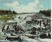 Manuels River Linear Park Municipal Heritage Site1.3 km
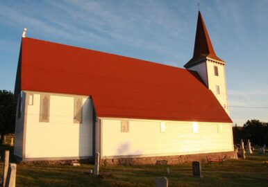 EnhancedSt. John the Evangelist Anglican Church Municipal Heritage Site1.8 km · 1860
 St. John the Evangelist Cemetery Municipal Heritage Site1.8 km
Similar places
Places whose register descriptions are closest to this one.
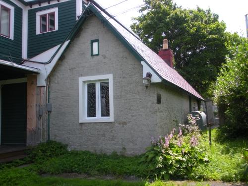 The Hermitage Municipal Heritage SiteConception Bay South, Newfoundland And Labrador
 The Hermitage Registered Heritage StructureConception Bay South, Newfoundland And Labrador
 Alderdice Property Municipal Heritage BuildingConception Bay South, Newfoundland And Labrador
 Brett Property Municipal Heritage SiteJoe Batt's Arm-Barr'd Islands-Shoal Bay, Newfoundland And Labrador
 Reddy Property Municipal Heritage SiteMarystown, Newfoundland And Labrador
 William Pardy Property Registered Heritage StructureBonavista, Newfoundland And Labrador
From the Canadian Register of Historic Places, as last updated on December 12, 2025. The register’s text is shown word for word.