Municipal Heritage Building, Structure or Land
Manuels River Linear Park Municipal Heritage Site
Conception Bay South, Newfoundland and Labrador
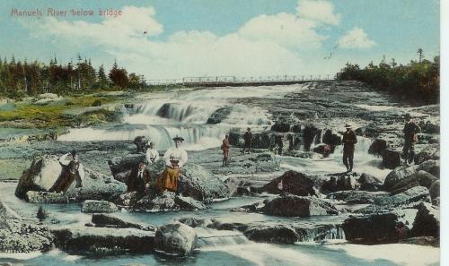
View of Manuels River looking generally south, towards the bridge. Colourized photo taken circa 1896.
Photo: Manuels River Natural Heritage Society 2008
- Recognized
- 2007
- By
- NL Municipality
The register’s text, word for word
Description
Manuels River Linear Park is a protected, natural conservation area which includes a river that flows into the east side of Conception Bay, and which extends approximately 14 kilometres within the town boundaries of Conception Bay South. A geologically rich area, the Manuels River Linear Park is a natural resource open to the public, with marked walking trails and boardwalks. The park is a habitat for a great variety of wildlife species from aquatic biota to aquatic invertebrates, insects, plants, animals and over thirty different species of wild flowers. The river runs through forest, wetlands and bogs and is an internationally-known site for fossilized trilobites. The municipal heritage designation is limited to the boundaries of the linear park.
Heritage value
Manuels River Linear Park has been designated a Municipal Heritage Site because it holds cultural and scientific values.
Manuels River Linear Park is culturally valuable because of the significance it holds to the residents of Conception Bay South, and particularly Manuels. Farmers and fishermen settled the community of Manuels in the early 1800s. The Manuels River valley was a leisure destination for local residents until 1882, when the community was connected to St. John’s by rail. Train excursions quickly became popular with St. John’s residents, and Manuels River became a favourite summer resort area. Hundreds of people flocked to the area, many staying for extended periods to camp and fish.
In the mid-1980s a group of local residents formed the Manuels River Natural Heritage Society to conserve and protect the river system, eventually becoming stewards of the river. The Manuels River Linear Park has grown to become one of the most popular attractions in Conception Bay South. The park offers more than six kilometres of walking trails, guided walks, special geology and flora tours and family campfires.
Manuels River Linear Park is scientifically valuable due to its unique geology, aquatic biology and paleontological features. 630 million years ago the area of the Manuels River lay on the volcanic fringe of the African continent. The land area later subsided below a sea in which sediments gradually accumulated. The rocks buckled as Africa collided with the North America plate 400 million years ago. Evidence of these events can be seen in the rocks exposed along the river valley.
The Ice Age changed the appearance of Manuels River. The valley upstream was moulded by a glacier that formed the broad, straight, shallow valley that we see today. Upstream the river has found it much more difficult to erode the tougher bedrock of conglomerate, granite and volcanic ash. The downstream part of the Manuels River has many curves and turns. The river has cut down into the easily eroded shale bedrock to form a gorge. The sea has created the beach, at the mouth of the Manuels River. It is made up of large cobbles of rock, which have been rounded by wave action and distributed up the beach according to size.
Manuels River is world-known for fossils found in the shale beds, most notably those of trilobites. Trilobites are an extinct class of marine arthropods that inhabited the earth’s oceans for more than 300 million years, from the Early Cambrian Period to the Late Permian Period. Resembling sow bugs or crabs trilobite fossils are easily found along the shale banks of the Manuels River. They were first discovered there by T. C. Weston of the Geological Survey of Canada in 1874.
SourceTown of Conception Bay South Regular Council Meeting Motion #07-096 March 6, 2007.
Character‑defining elements
All those elements of the natural conservation zone, including:
-natural setting of the park amongst growing, urban development;
-fossil site;
-variety of exposed bedrock, including the various kinds of volcanic rocks and sedimentary rocks which are easily accessible from the river banks;
-the beach, which shows the processes of erosion, and the deposition of beach rock, enabling close geological study;
-evidence of ancient geological activity, ie. volcanic eruptions and plate tectonics; and -wide variety of species in their natural habitats, including flora, fauna, animal and bird wildlife.
End of the register’s text
Location
Conception Bay South, Newfoundland and Labrador, A1W, Canada
47.52071° N, 52.94624° W
Get directions (opens in a new tab)Being on the register doesn’t make a place open to visitors. Many are private homes or businesses; please view them from the street.

Loading map…
 St. Thomas of Villa Nova Cemetery Municipal Heritage Site350 m
 Chisholm House Municipal Heritage Site400 m · 1904
 Dawe Property World War Two Site Municipal Heritage Site1.1 km · Conception Bay South (Manuels)
 The Herder Property Municipal Heritage Site1.3 km · 1932
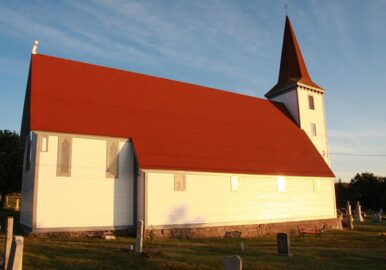 EnhancedSt. John the Evangelist Anglican Church Municipal Heritage Site2 km · 1860
 St. John the Evangelist Church2 km · 1860
Similar places
Places whose register descriptions are closest to this one.
- Man-of-War Brook Municipal Heritage SiteHarbour Breton, Newfoundland And Labrador
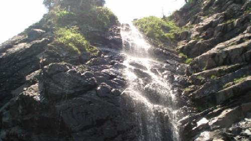 Branch Cove Fossiliferous Rocks Municipal Heritage SiteBranch, Newfoundland And Labrador
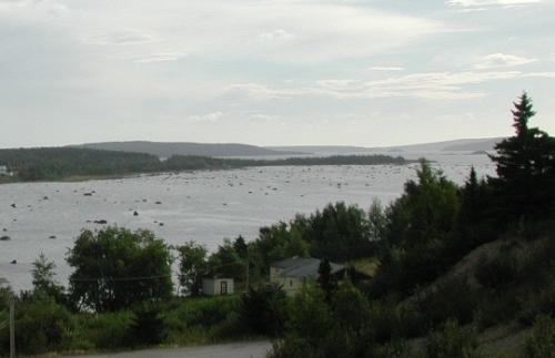 Doloman's Point Municipal Heritage SiteGambo, Newfoundland And Labrador
 Deadman’s Cove Municipal Heritage SiteHarbour Breton, Newfoundland And Labrador
 The Downs Historic Conservation AreaFerryland, Newfoundland And Labrador
 Beaver Pond Municipal Heritage SiteHarbour Breton, Newfoundland And Labrador
From the Canadian Register of Historic Places, as last updated on December 12, 2025. The register’s text is shown word for word.