National Historic Site of Canada
Pointe-du-Buisson National Historic Site of Canada
Beauharnois, Quebec
Also known as Pointe-du-Buisson, Pointe-du Buisson Archaeological Park, Parc archéologique de la Pointe-du-Buisson
- Recognized
- 2005
- By
- Government of Canada
The register’s text, word for word
Description
Pointe-du-Buisson National Historic Site of Canada is made up of several archaeological sites spread over a wooded plateau on a point of land along the Saint Lawrence River in Beauharnois, 30 kilometres south of Montreal. The site is an average height of 34 metres above sea level, and is cut into three unequal parts by two small steep-sloped ravines. The space contains 15 separate archaeological sites, the remains of which provide important information about Indigenous life in the area over the last five millennia. The designation refers to the archaeological remains and the 21-hectare site on which they have been found.
Heritage value
Pointe-du-Buisson was designated a National Historic Site of Canada in 2005. It is recognized because:
- it documents the history of Aboriginal populations over the last five millennia who lived in the southwestern part of Quebec and used the waterway of the Upper St. Lawrence in their travels. This vast archaeological complex is one of the rare sites located in eastern Canada that feature such a long occupation sequence and such a wealth of artifacts;
- it demonstrates the importance of fishery resources in the subsistence of the groups that used the site, particularly during the Late Middle Woodland period when a stable economy characterized by intensive fishing endured for five centuries (1500 to 1000 BP); and,
- it has become a reference point that is essential to any study aimed at understanding the history of Aboriginal populations of this region.
Pointe-du-Buisson was an ancient location for portage camps and settlement on the banks of a critical transportation route. The western part of the site contains nine archaeological sites (Hector Trudel, Station 2, Station 3 front, Station 3 rear, Plateau-des-portageurs, Pascal Mercier, Camp McKenzie, Jane Ellice and Passerelle). It is a large area that has been used continuously since 5000 BP. The central part has three sites (Station 4, Trois Buttes and Pointe-à-Jonathan), which were occupied primarily in the Late Middle Woodland period (1500-1000 BP). The eastern part has two sites (Station 5 and André Napoléon Montpetit) that provide exceptional documentation of an episode of Early Woodland occupation (3000-2400 BP).
The heritage value of Pointe-du-Buisson National Historic Site resides in the rare and excellent witness it bears to a long period of early aboriginal history. Its value lies in its sites, their settings, and the wealth of artifacts and knowledge they contain.
SourceHistoric Sites and Monuments Board of Canada, Minutes, December 2004.
Character‑defining elements
Key elements contributing to the heritage value of this site include:
- the completeness of these sites individually and as a grouping;
- its location on a major historic transportation route beside a portage area, in an excellent camping, fishing and hunting site;
- the site’s setting on a point of land overlooking a vast area of rapids, with water along most of its perimeter;
- the presence of deep ravines with high sloped sides, and the large flat well-drained area of the plateau;
- the nature of its soil, Potsdam sandstone covered by slightly acidic argillaceous humus; its natural forest, comprised mostly of maple trees mixed with hickory, providing a hospitable open forest floor with well-spaced trunks;
- the presence of rare plant species on site;
- the long period and diverse nature of artifacts found in the largest site, the western site, and in particular remnants of the following periods: Laurentian Archaic (6000-4200 BP), post Laurentian Archaic (4200-3000 BP), Lamoka (4200-3000 BP), and Susquehanna (3600-3000 BP), Early Woodland (3000-2400 BP), Early Middle Woodland (2400-1500 BP), and Late Middle Woodland (1500-1000 BP), Late Woodland (1000-500 BP), historical period (400 BP to today);
- the rich concentration of artifacts of the Late Middle Woodland period (1500-1000 BP) in the central portion of the site, particularly ceramic demonstrating the Melocheville tradition;
- the rich concentration of artifacts of the Early Woodland period (3000-2400 BP) in the eastern portion of the site, and in particular ceramic shards and stone tools shaped from bifacial cores;
- continuous association of all artifacts and all knowledge gleaned from the site with the site itself;
- evidence of higher waterlines before the construction of the hydroelectric dam.
End of the register’s text
Location
333 Émond Street, Beauharnois, Quebec, Canada
45.31532° N, 73.96628° W
Get directions (opens in a new tab)Being on the register doesn’t make a place open to visitors. Many are private homes or businesses; please view them from the street.

Loading map…
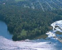 Site archéologique de la Pointe-du-Buissonwithin 100 m
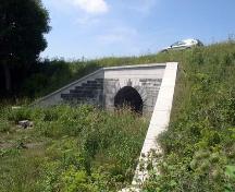 Aqueduc de la Rivière-Saint-Pierre2.8 km · Salaberry-de-Valleyfield · 1843
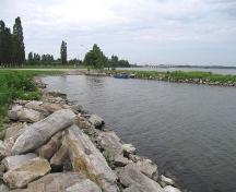 Site historique de l'Entrée-Inférieure-de-l'Ancien-Canal-de-Beauharnois3.1 km · 1842
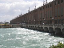 Beauharnois Power Development National Historic Site of Canada4.5 km · 1929
 Battle of the Cedars National Historic Site of Canada5.1 km · Les Cèdres
 Église de Sainte-Jeanne-de-Chantal6.3 km · Notre-Dame-de-l'Île-Perrot · 1773
Similar places
Places whose register descriptions are closest to this one.
 Port au Choix National Historic Site of CanadaPort au Choix, Newfoundland And Labrador
 Cartier-Brébeuf National Historic Site of CanadaQuébec, Quebec
 Fort St-Louis National Historic Site of CanadaKahnawake, Quebec
 Fort St. Joseph National Historic Site of CanadaSt. Joseph Island / Île St. Joseph, Ontario
 Blanc-Sablon National Historic Site of CanadaBlanc-Sablon, Quebec
 EnhancedÎle aux Basques National Historic Site of CanadaÎle aux Basques, Quebec
From the Canadian Register of Historic Places, as last updated on December 12, 2025. The register’s text is shown word for word.