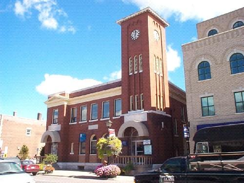
Photo: City of Sault Ste. Marie
- Construction
- 1902–1906
- Reconnaissance
- 1983
- Par
- Administrations locales (Ont.)
Le texte du répertoire, mot pour mot
Description
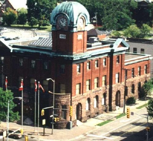
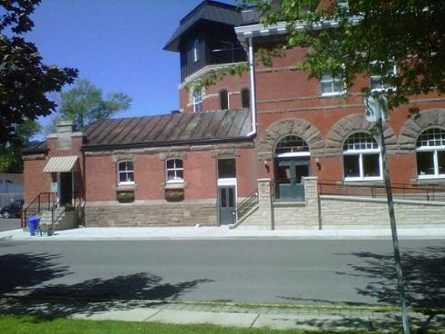
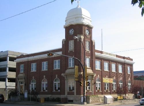
The Old Post Office is an imposing three storey red brick and stone building featuring a clock tower. It is prominently located in downtown Sault Ste. Marie at the intersection of Queen Street East and East Street. Built between 1902 and 1906 as a federal building, it was purchased in 1982 by the City for use as the Sault Ste. Marie Museum.
The Old Post Office has been recognized for its heritage value by the City of Sault Ste. Marie, By-Law 83-266.
Valeur patrimoniale
Designed in 1902 by David Ewart, Chief Architect of the federal government’s Department of Public Works, the Old Post Office is a fine example of turn of the century Federal architecture in Ontario, combining Victorian classicism with excellent workmanship.
Embracing a number of classical styles, the Old Post Office is a landmark building that dominates the downtown core. Its construction at the turn of the century reflects a confidence in Sault Ste. Marie's future as an industrial centre.
Like other significant Sault Ste Marie buildings of this period, local materials excavated during the building of the Sault Ste. Marie canal have been integrated into the building.
SourceSault Ste. Marie Designation By-law 83-266; Old Post Office Designation Report
Éléments caractéristiques
Key character defining elements that reflect the building's value as a fine example of turn of the century Federal architecture in Ontario include:
Exterior elements:
- classical pediments, pilasters and cornices
- Romanesque stone arches
- Italianate detailing and decorative features
Interior elements include:
- the oak staircase
- exquisite three-story light well and skylight
- plated glass floor
Key character defining elements reflecting turn of the century confidence in Sault Ste. Marie include:
- its imposing size
- dominant location
- three stories
- imposing clock tower
Key character defining elements that demonstrate the use of local materials include:
- squared local rubble sandstone
- red brick facades
Fin du texte du répertoire
Emplacement
46.50802° N, 84.32780° W
Itinéraire (s’ouvre dans un nouvel onglet)L’inscription au répertoire ne rend pas un lieu accessible au public. Beaucoup sont des résidences ou des commerces privés; admirez-les depuis la rue.

Chargement de la carte…
À proximité
Les 34 lieux de Sault Ste. Marie
Lieux semblables
Les lieux dont la description du répertoire se rapproche le plus de celle-ci.
Tiré du Répertoire canadien des lieux patrimoniaux, dans sa dernière mise à jour du 12 décembre 2025. Le texte du répertoire est reproduit mot pour mot.