Endroit historique inscrit au répertoire
Indian River Pioneer Roman Catholic Cemetery
Indian River, Ile Du Prince Edouard
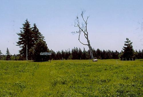
Photo: PEI Genealogical Society, George Sanborn Jr., 2009
- Reconnaissance
- 2010
- Par
- Province de l'Île-du-Prince-Édouard
Le texte du répertoire, mot pour mot
Description
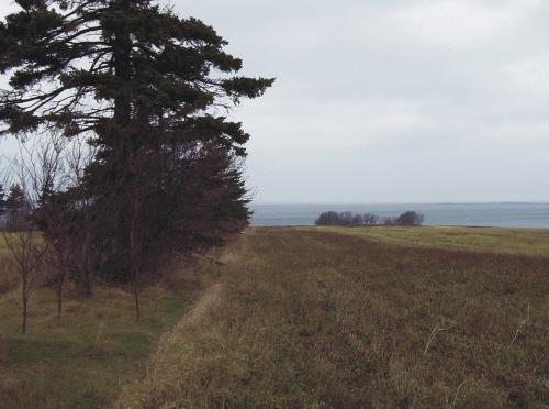
This small pioneer cemetery is located on the eastern side of the Easter Road which is a clay road leading from the MacLellan Road and running through large potato fields. It is known locally as Shore Lane Cemetery and contains several gravestones and a large cross. A sign identifys the name of the site.
Valeur patrimoniale
The cemetery is valued for its historical association with St. Mary's Roman Catholic parish in Indian River and the early settlement of the area.
The first Roman Catholic church in the area was constructed near this cemetery in 1815. In 1855, it was hauled across the ice to Summerside and used as a church there. Another church was constructed in 1843 on the site of the current St. Mary's Church in Indian River. It was destroyed by fire in 1896 and replaced by the current structure in 1902.
Settlement in the area began in the 1780s with Highland Scots arriving from South Uist in the Outer Hebrides. Among these were the families of John and Angus MacLellan whose descendants still reside in the area and began the restoration of the site in 1987.
Although the sign on the cemetery grounds indicates that it began in 1812, it is believed there were earlier burials on the site which now do not have any markers. There are several remaining stones with inscriptions and a large cross on the site, as well as several smaller iron crosses.
The cemetery remains an important cultural and genealogical resource in the area and is a tangible reminder of the earliest settlers of Indian River.
Source: Culture and Heritage Division, PEI Department of Tourism and Culture, Charlottetown, PE C1A 7N8
File #: 4310-20/P43
Éléments caractéristiques
The heritage value of the cemetery is shown in the following character-defining elements:
- the location of the cemetery off Easter Road near potato fields
- the distinctive sign marking the name of the site
- the remaining headstones with inscriptions
- the tall wooden cross
- the smaller iron crosses
- the potential for unmarked graves on the site
Fin du texte du répertoire
Emplacement
46.47160° N, 63.68950° W
Itinéraire (s’ouvre dans un nouvel onglet)L’inscription au répertoire ne rend pas un lieu accessible au public. Beaucoup sont des résidences ou des commerces privés; admirez-les depuis la rue.

Chargement de la carte…
À proximité
Les 3 lieux de Indian River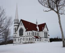

Lieux semblables
Les lieux dont la description du répertoire se rapproche le plus de celle-ci.
- Park Corner Pioneer Roman Catholic CemeteryPark Corner, Ile Du Prince Edouard
 Lot 7 Pioneer Roman Catholic CemeteryBurton, Ile Du Prince Edouard
- North Carleton Pioneer CemeteryNorth Carleton, Ile Du Prince Edouard
 St. Brigid's Old Roman Catholic CemeteryFoxley River, Ile Du Prince Edouard
- St. Anne's Pioneer CemeteryStanley Bridge, Ile Du Prince Edouard
 Portage Shore Pioneer CemeteryBrackley Point, Ile Du Prince Edouard
Tiré du Répertoire canadien des lieux patrimoniaux, dans sa dernière mise à jour du 12 décembre 2025. Le texte du répertoire est reproduit mot pour mot.