Endroit historique inscrit au répertoire
St. Brigid's Old Roman Catholic Cemetery
Foxley River, Ile Du Prince Edouard
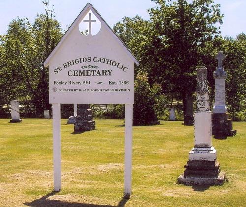
Photo: PEI Genealogical Society, George Sanborn Jr., 2009
- Construction
- 1866–1919
- Reconnaissance
- 2010
- Par
- Province de l'Île-du-Prince-Édouard
Le texte du répertoire, mot pour mot
Description
This pioneer cemetery is located near the intersection of the Canadian Road (former road to the Walshtown Ferry) on Route 168 and Route 12 in Foxley River. The site extends along the northeastern bank of the Foxley River diagonally across the road from St. Brigid's Roman Catholic Church.
Valeur patrimoniale
The cemetery is valued for its historical association with the early Irish and Scottish settlers of the area.
St. Brigid's Parish was established in 1876 to serve the growing needs of the Roman Catholic people of Lot 11. It was originally part of St. Anthony's Parish in Lot 5.
The cemetery dates from 1866 and contains stones detailing the names of many Irish settlers from King's (now County Offaly) and Queen's (now County Laois) counties in Ireland. These pioneers both Roman Catholic and Protestant were recruited to come to PEI by John Large on behalf of the proprietor of Lot 11.
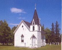
The St. Brigid's Parish Church was constructed nearby from 1868 to 1873. It is a provincial registered heritage place. The church is now closed for regular services and only used during the summer months for special events. The cemetery's care and maintenance is completed by St. Anthony's Parish.
The cemetery was replaced by another nearby in 1919 and was only used for occasional burials. It is well maintained today and displays a new sign donated by the Knights of Columbus. It is an important cultural and genealogical resource in the area.
Source: Culture and Heritage Division, PEI Department of Tourism and Culture, Charlottetown, PE C1A 7N8
File #: 4310-20/P42
Éléments caractéristiques
The heritage value of the cemetery is shown in the following character-defining elements:
- the location of the cemetery near the Foxley River and across from St. Brigid's Church
- the various gravestones and their inscriptions
- the sign identifying the site
Fin du texte du répertoire
Emplacement
46.69270° N, 64.01340° W
Itinéraire (s’ouvre dans un nouvel onglet)L’inscription au répertoire ne rend pas un lieu accessible au public. Beaucoup sont des résidences ou des commerces privés; admirez-les depuis la rue.

Chargement de la carte…
À proximité
Lieux semblables
Les lieux dont la description du répertoire se rapproche le plus de celle-ci.
 Indian River Pioneer Roman Catholic CemeteryIndian River, Ile Du Prince Edouard
 Lot 7 Pioneer Roman Catholic CemeteryBurton, Ile Du Prince Edouard
- St. Anne's Pioneer CemeteryStanley Bridge, Ile Du Prince Edouard
 Cape Wolfe Pioneer Roman Catholic CemeteryCape Wolfe, Ile Du Prince Edouard
- Park Corner Pioneer Roman Catholic CemeteryPark Corner, Ile Du Prince Edouard
 123 St. Peters Road / St. Peters Anglican CemeteryCharlottetown, Ile Du Prince Edouard
Tiré du Répertoire canadien des lieux patrimoniaux, dans sa dernière mise à jour du 12 décembre 2025. Le texte du répertoire est reproduit mot pour mot.