Municipal Register of Local Historic Places
Fox Creek Aboiteau
Dieppe, New Brunswick
Also known as Aboiteau de Fox Creek
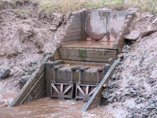
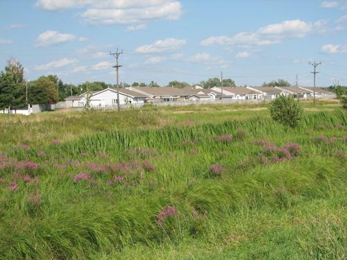
View of the dam and flap gate
Photo: City of Dieppe
- Recognized
- 2008
- By
- Local government
The register’s text, word for word
Description
The Fox Creek Aboiteau includes vestiges of an aboiteau that was built around 1800 which are found below Pointe-aux-Renards Street in the Fox Creek area of Dieppe, and include the dyke. This aboiteau is recognized for its association with the use of the salt marshes by the Acadians in the 19th and 20th centuries.
Heritage value
The heritage value of the remains of the Fox Creek Aboiteau resides in their association with the use of the marshes by the Acadians between 1800 and 1980. Around 1800, approximately fifteen years after the pioneers came to Fox Creek and Saint-Anselme around 1785-86, they began building this aboiteau. An aboiteau may have existed before 1755 in the same location, since Acadian families have settled at Fox Creek since the late 1740’s.
Maintaining the canals, the dykes, and the aboiteau was the community responsibility of the owners of the marshes. The costs were assumed by the Province. Around 1875, a new aboiteau was erected a little to the west of the first one, the remains of which are incorporated into the more modern one that was built by the federal government around 1940.
In 1911, 39 landowners shared 186 acres of marshes. An acre was valued at $25 to $56, and the total value of the marshes was $10,093.25. In 1915, dyke repairs totaled $373. The approximately 20 owners, most of the shovelers, put in 333 hours of work, and were paid $1.75 per day. The seven workers who provided their own teams of horses to haul earth, branches, and wood were paid $3.50 per day. Some were helped by their teenage sons.
SourceCity of Dieppe, Historic Places File (2), D11
Character‑defining elements
The character-defining elements describing the Fox Creek Aboiteau are:
- location on the banks of the creek;
- archeological vestiges;
- dykes;
- current flap gate and dam.
End of the register’s text
Location
Chantal Street, Dieppe, New Brunswick, E1A, Canada
46.05733° N, 64.70489° W
Get directions (opens in a new tab)Being on the register doesn’t make a place open to visitors. Many are private homes or businesses; please view them from the street.

Loading map…
Nearby
All 53 places in Dieppe
Similar places
Places whose register descriptions are closest to this one.
From the Canadian Register of Historic Places, as last updated on December 12, 2025. The register’s text is shown word for word.