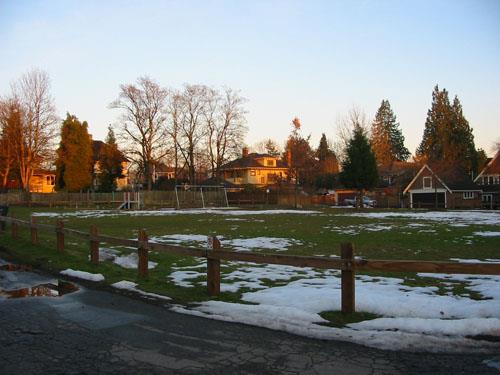
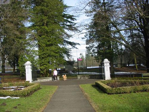
Sullivan Park
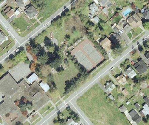
Photo: City of New Westminster, 2009
- Built
- 1939
- Recognized
- 2009
- By
- Local government
The register’s text, word for word
Description
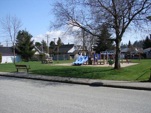
Sullivan Park is a small neighbourhood green space located at the center of a residential block at the end of Oliver Street in the Queen’s Park neighbourhood of New Westminster.
Heritage value
Sullivan Park is important for its representation of the history and evolution of the city and for its community values.
The park is important for its original status as St. Patrick’s Square, a remnant of Colonel Moody’s original plan for New Westminster, which set aside lands for squares, parks and government reserves. It is also significant for its representation of the evolution of the city, as in 1885 the city acquired title to provincial land reserves and squares, subdivided the land, and auctioned off the lots to raise needed funds.
The park is important aesthetically for its small scale, location within a residential block, its intimate relationship to the surrounding residences, and its village square feel.
The park is also valued for its association with the Sullivan family, a prominent New Westminster family who lived on Park Crescent near Queen’s Park from 1912. Arriving from Ireland in the late 1800s, the family settled in Surrey in 1900 because of the vast timber wealth there, and started the successful Sullivan Mills.
SourceCity of New Westminster Planning Department
Character‑defining elements
Key elements that define the heritage character of Sullivan Park include its:
Context Siting and Landscape
- location within a residential block of Queen’s Park
- close relationship to the houses surrounding the park
- narrow road access and the lane surrounding the park
- bollards which define the park perimeter
- open space with few trees, reminiscent of a village square
- play equipment and park furniture
End of the register’s text
Location
315 Oliver Street, New Westminster, British Columbia, Canada
49.21203° N, 122.91034° W
Get directions (opens in a new tab)Being on the register doesn’t make a place open to visitors. Many are private homes or businesses; please view them from the street.

Loading map…
Similar places
Places whose register descriptions are closest to this one.
From the Canadian Register of Historic Places, as last updated on December 12, 2025. The register’s text is shown word for word.