Provincial Park
Steele Narrows Provincial Park
Loon Lake RM 561, Saskatchewan
Also known as Archaeological Site GaOh-2
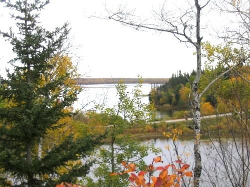
View north at the narrows, 2004.
Photo: Government of Saskatchewan, Marvin Thomas, 2004.
- Recognized
- 1986
- By
- Government of Saskatchewan
The register’s text, word for word
Description
Steele Narrows Provincial Park encompasses an important late nineteenth-century battlefield. The park consists of 88 hectares of forested, hilly land on either side of the narrows between Makwa Lake and Sanderson Bay, approximately 10 kilometres west of the community of Loon Lake.
Heritage value
The heritage value of Steele Narrows Provincial Park lies in its status as the location of the last military engagement of the North-West Resistance of 1885, and in its association with several prominent figures of the period. On June 3, 1885, the site was the scene of a pitched battle between Major Samuel Steele’s Scouts of the Alberta Field Force and a group of Cree led by mistahi-maskwa (Big Bear), pápamácákiwéw (Wandering Spirit) and ayimisís (Imasees). When the fighting was over, at least four, and perhaps as many as 15, Cree were dead. Among the casualties were Chief sakáskoc (Seekaskootch) and two companions who were struck down while attempting to mediate a truce. Several Scouts were wounded. With their superior knowledge of the environment, the Cree were able to withdraw into the forest following the battle. General Frederick Middleton later attempted a pursuit, but soon gave up in the face of nearly impassable muskeg and dense woods.
The former battlefield is also valued by First Nations as a symbol of resistance, and as a pilgrimage site where ancestors are honoured. Ceremonies conducted in the park maintain cultural and spiritual connections with the past, and express the survival and resilience of First Nations culture.
Source:
Province of Saskatchewan, The Parks Act, May 26, 1986.
Character‑defining elements
The heritage value of Steele Narrows Provincial Park resides in the following character-defining elements:
-elements that evoke a sense of the 1885 battle, including the park's virtually unchanged natural landscape of forest, hills, muskeg and lake, which allows visitors to readily envision the scene of the fighting;
-elements that commemorate the battle, including marked and un-marked grave sites, and concrete pylons that denote key events of the confrontation, such as the ford across the narrows, spots where Cree casualties fell, and locations where gunfire was exchanged;
-elements that reveal information regarding the battle, including archaeological remains and the spatial relationships and environmental context of the remains;
-elements that speak to the park’s cultural value, such as access to the park for First Nations to pay honour to their ancestors or for other ceremonial purposes.
End of the register’s text
Location
Loon Lake RM 561, Saskatchewan, S0M, Canada
54.04075° N, 109.31767° W
Get directions (opens in a new tab)Being on the register doesn’t make a place open to visitors. Many are private homes or businesses; please view them from the street.

Loading map…
Nearby
Similar places
Places whose register descriptions are closest to this one.
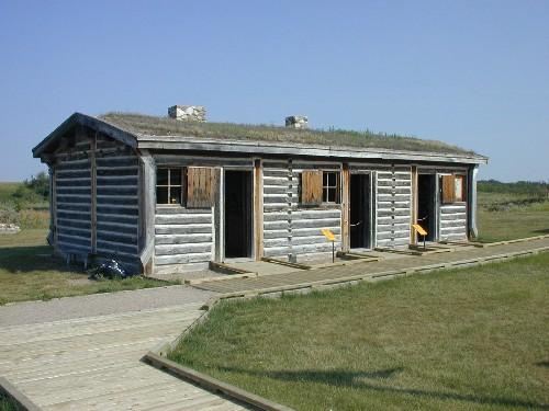 Last Mountain House Provincial ParkLonglaketon RM 219, Saskatchewan
 Fort Pitt Provincial ParkFrenchman Butte RM 501, Saskatchewan
 Wood Mountain Post Provincial ParkOld Post RM 43, Saskatchewan
 Fort Carlton Provincial ParkDuck Lake RM 463, Saskatchewan
 Pine Island Trading Post Protected AreaTurtle River RM 469, Saskatchewan
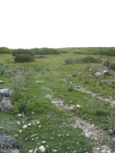 Fort Livingstone Protected AreaLivingston RM 331, Saskatchewan
From the Canadian Register of Historic Places, as last updated on December 12, 2025. The register’s text is shown word for word.