Memramcook Marsh
Also known as: Memramcook Marsh, LePlate Marsh, Marais des LePlate
Description
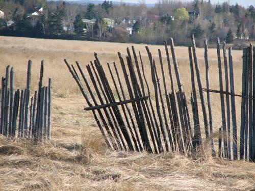
Memramcook Marsh, a parcel of meadowland, is located in the western part of the large marsh in the former Village-des-LePlate. It extends from either side of La Vallée Highway, from McGinleys Corner to Memramcook Corner.
Heritage Value
Memramcook Marsh is designated a Local Historic Place for its association with regional development.
Memramcook Marsh is recognized for the important role played by marshes in the recolonization of Memramcook around 1765 and during the Acadian renaissance. It was the marshes that drew settlers to Memramcook when they left Fort Beauséjour and Fort Edward following the signing of the Treaty of Paris. The importance of marshes is reflected in the very pronounced division of the marsh into increasingly smaller parcels. Contrary to uplands, which were handed down to a limited number of heirs, a parcel of meadowland was often passed on to each child in a family. Once they were dyked, marshes served as the principal source of hay for cattle and horses. The construction and maintenance of dykes and aboiteaux were a group responsibility shared by the entire community. This often ensured that each descendent could benefit from them.
Source: Village de Memramcook - Site File "Le marais de Memramcook"
Character-Defining Elements
The character-defining elements that describe Memramcook Marsh include:
- limited size of the parcel of meadowland;
- irrigation ditch surrounding the land, making it possible to dry the land out enough to harvest the hay in the summer;
- marsh road providing access to the land.
Gallery
2 imagesLocation
Loading map...
Similar Places
Heritage sites with similar characteristics