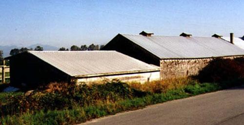
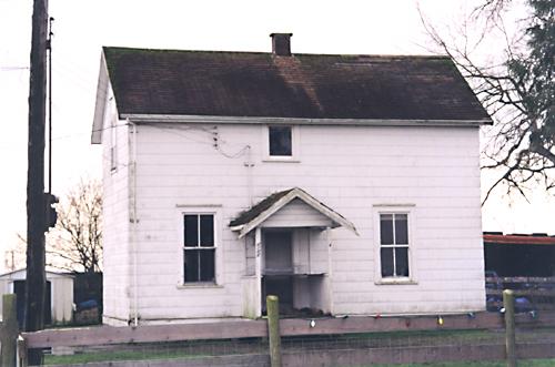
Exterior view of the Gilmore Potato Pit, 2000
Photo: City of Richmond, 2000
- Built
- 1930
- Recognized
- 2003
- By
- Local government
The register’s text, word for word
Description
The Gilmore Potato Pit is a rectangular, gabled barn situated with its long side parallel to a narrow roadway. It sits within a context of buildings of similar character, agricultural fields and the distinct Slough District landscape.
Heritage value
The Gilmore Potato Pit is one of a group of heritage resources that help the South Arm Slough District maintain its distinct historic rural character. Local farmer Leslie Gilmore was a significant figure in the development of farming practice in Richmond. Through Leslie Gilmore, the barn is associated with organizations which represented early movements in the farming industry to improve crops and guarantee a fair price to local growers.
The building is considered to be a very good example of a calf barn structure, consisting of two connected buildings. Originally built as a calf barn, it is now used for potato storage. An award winning dairy farmer, Leslie Gilmore once owned the largest herd of Holsteins in Canada. The cultivation of potatoes was also of particular interest to Mr. Gilmore, and in 1944 he obtained the highest yield in Canada of Netted Gem potatoes.
Its location, both in the South Arm Slough District, and at the edge of and below the grade of the dyke, is also significant, relative to the agricultural history of this area and the importance of dyking and drainage to Richmond's farmers.
SourceCity of Richmond Clerk's Department
Character‑defining elements
Key elements that define the heritage character of the Gilmore Potato Pit include:
- the rectangular construction of the potato pit as two connected buildings, both with a side gable roof, to facilitate its origial use as a calf barn
- the larger potion of the building has three monitor vents and a chimney in the roof
- its location in the South Arm Slough District, which is one of the oldest farming areas in Richmond, and maintains this rural character and connection to farming today
- its proximity to and its lower grade relative to the dyke
- the relationship to the development of modern farming practices in Richmond through the efforts of local farmer Leslie Gilmore
End of the register’s text
Location
10631 Dyke Road, Richmond, British Columbia, V7A, Canada
49.11640° N, 123.10840° W
Get directions (opens in a new tab)Being on the register doesn’t make a place open to visitors. Many are private homes or businesses; please view them from the street.

Loading map…
Similar places
Places whose register descriptions are closest to this one.
From the Canadian Register of Historic Places, as last updated on December 12, 2025. The register’s text is shown word for word.