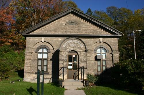
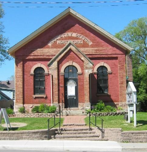
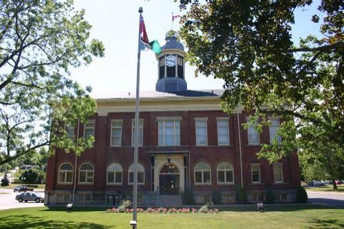
Photo: Susan Schappert, 2007
- Reconnaissance
- 1992
- Par
- Administrations locales (Ont.)
Le texte du répertoire, mot pour mot
Description
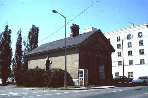
This one storey, pedimented, brick building is located at the intersection of Mill and Walton Streets, at the eastern end of Port Hope's downtown commercial district. Set at the bottom of a large hill, at 17 Mill Street North, the Registry Office faces west, looking across the road to the Ganaraska River.
The Registry Office is recognized for its heritage value, by the Town of Port Hope By-law 05/92 Schedule B-1, passed on January 20, 1992.
Valeur patrimoniale
The Registry Office has architectural merit as an excellent example of the County Registry post-Confederation prototype. Its form is loosely inspired by the neo-classical, with its formal pedimented front. The building is composed of three brick vaults laid next to each other, in order to fulfill the fireproofing requirements for a depository for legal documents. It was designed by architect Kivas Tully, during his tenure, as the senior architect and engineer of the Ontario Public Works Department.
The building was originally the East Durham County Land Registry Office, from 1871 to 1992. Its construction is commemorated, in the sign “East Durham 1871” ,over the building's main entrance. Port Hope, now part of Northumberland County, was originally part of Durham County, in the 19th century.
After the amalgamation of land record offices, in 1992, the Port Hope Registry Office was closed and records were transferred, to the new County office, in Cobourg. The building was purchased by the Town of Port Hope, and leased to the Ganaraska Regional Archives, which is now the Port Hope Archives.
SourceHeritage Designation By-law 05/92 Schedule B-1, Municipality of Port Hope, Heritage Port Hope Files, Port Hope Town Hall, 56 Queen Street; Port Hope Archives, 17 Mill Street N., Port Hope.
Éléments caractéristiques
Character defining elements that reflect the heritage value of the Registry Office include its:
- simple one storey form, constructed of three brick vaults, built next to each other
- symmetrical three bay facade, with projecting vestibule
- buff brick exterior walls
- medium pitch gable roof, with front-facing pediment
- semi-circular arched door and window openings
- recessed arched brick panels and keystones
Fin du texte du répertoire
Emplacement
43.95118° N, 78.29187° W
Itinéraire (s’ouvre dans un nouvel onglet)L’inscription au répertoire ne rend pas un lieu accessible au public. Beaucoup sont des résidences ou des commerces privés; admirez-les depuis la rue.

Chargement de la carte…
À proximité
Les 56 lieux de Port Hope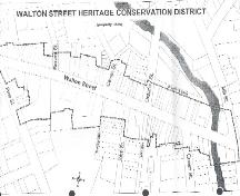 Walton Street Heritage Conservation District, Downtown Port Hopeà moins de 100 m
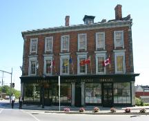 Waddell Blockà moins de 100 m · 1845
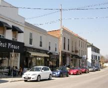 John, Ontario and Queen Street Heritage Conservation Districtà moins de 100 m
 34-46 Walton Street, Port Hopeà moins de 100 m · 1849
 Port Hope Capitol Theatre100 m · 1930
 St. Mark's Anglican Church150 m · 1822
Lieux semblables
Les lieux dont la description du répertoire se rapproche le plus de celle-ci.
Tiré du Répertoire canadien des lieux patrimoniaux, dans sa dernière mise à jour du 12 décembre 2025. Le texte du répertoire est reproduit mot pour mot.