Bien patrimonial provincial
Pasquia Palaeontological Site, Jordon River
Arborfield RM 456, Saskatchewan
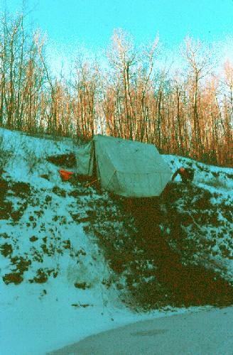
Photo: Government of Saskatchewan, Royal Saskatchewan Museum, 1991.
- Reconnaissance
- 1995
- Par
- Gouvernement de la Saskatchewan
Le texte du répertoire, mot pour mot
Description
The Pasquia Palaeontological Site, Jordan River is a Provincial Heritage Property consisting of 100 hectares of land adjoining the south bank of the Carrot River near the Town of Carrot River. The site features exceptional deposits of Cretaceous-age marine fossils that were discovered in sediments eroding from the riverbank.
Valeur patrimoniale
The heritage value of the Pasquia Palaeontological site resides in the scientific information it reveals regarding the species and paleo-environment of a little known period of Saskatchewan’s geologic history. Fossils collected from the site represent the best record in Canada of vertebrate marine life from the period 92 to 95 million years ago. The quality and quantity of the marine fossils of this age are unmatched in North America. Among the sharks, cartilaginous and bony fish, and marine reptiles was a giant crocodilian (Terminonaris), the most complete and best-preserved of four such specimens known in North America. The site is also important for fossils of a group of toothed, non-flying aquatic birds, the oldest and most abundant collection of its kind, and for fossils of other species new to science.
Sources:
Province of Saskatchewan, Notice of Intention to Designate as Provincial Heritage Property under The Heritage Property Act, March 9, 1995.
Province of Saskatchewan, Order to Designate as Provincial Heritage Property under The Heritage Property Act, July 13, 1995.
Éléments caractéristiques
The heritage value of the Pasquia Palaeontological Site, Jordan River resides in the following character-defining elements:
-the stratigraphic sequence of sediments on and adjacent to the south bank of the Carrot River, particularly the Cretaceous age shales, and their contained fossils.
Fin du texte du répertoire
Emplacement
53.17196° N, 103.52240° W
Itinéraire (s’ouvre dans un nouvel onglet)L’inscription au répertoire ne rend pas un lieu accessible au public. Beaucoup sont des résidences ou des commerces privés; admirez-les depuis la rue.

Chargement de la carte…
À proximité
Lieux semblables
Les lieux dont la description du répertoire se rapproche le plus de celle-ci.
 La Roche Percee Provincial Historic SiteCoalfields RM 4, Saskatchewan
 Swift Current Creek Petroglyph BoulderSwift Current RM 137, Saskatchewan
 Harder Archaeological Site Protected AreaCorman Park RM 344, Saskatchewan
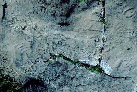 St. Victor Petroglyphs Provincial ParkWillow Bunch RM 42, Saskatchewan
 Walter Felt Bison Drive Protected AreaWheatlands RM 163, Saskatchewan
 Niska SiteAuvergne RM 76, Saskatchewan
Tiré du Répertoire canadien des lieux patrimoniaux, dans sa dernière mise à jour du 12 décembre 2025. Le texte du répertoire est reproduit mot pour mot.