Photo: City of Sault Ste. Marie
- Construction
- 1904
- Reconnaissance
- 1983
- Par
- Administrations locales (Ont.)
Le texte du répertoire, mot pour mot
Description
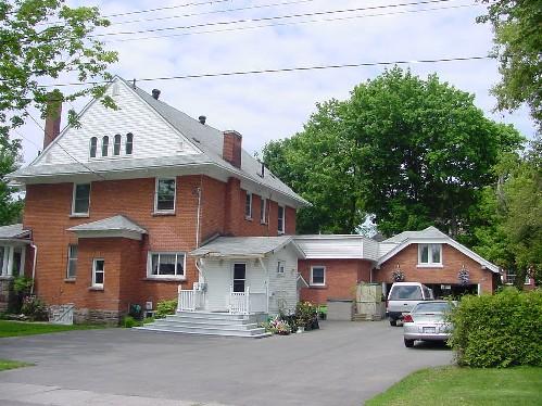
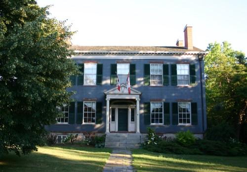
This two-storey red brick and local red sandstone residence is well sited on a large treed lot at the south west corner of Queen Street East and Upton Road in the east end of the central residential core of Sault Ste. Marie. It is in close proximity to several other homes of similar age and character in the area. A single storey garage or carriage house is found at the rear of the lot, facing Upton Road.
Eastbourne has been recognized for its heritage value by the City of Sault Ste. Marie, By-law 83-266.
Valeur patrimoniale
William Howard Hearst established a legal practice in Sault Ste. Marie in 1888 and in 1904 built "Eastbourne" as his residence, naming it for its location in the east end of town. In 1908 Hearst became the Member of Provincial Parliament for Algoma and in 1914 the first Premier of Ontario from Northern Ontario. He resigned from politics after the Conservative defeat in 1919.
Eastbourne is as good example of Edwardian architecture utilizing local materials in Sault Ste. Marie. It was constructed in 1904 with a 't-shaped' plan; each of the arms the same width and projection. Two-storeys in height with a full basement and attic, it is constructed of soft red brick and local red sandstone.
SourceSault Ste. Marie Designation By-law 83-266; Eastbourne – 1048 Queen Street East Designation Report.
Éléments caractéristiques
Character-defining elements include its:
- 't-shaped' plan
- gabled roof
- attic gables, clad with painted wood shingles
- the deep cornice and soffits with decorative brackets
- the large bow windows dominating the east and west facades
- the triple and double hung sash windows
- the spandrels between the upper and lower windows
- the porch, with its broken pediment, pilasters and triple clusters of truncated Doric columns
- the chimneys
- basement and porch foundations of local red sandstone
Fin du texte du répertoire
Emplacement
46.50555° N, 84.31402° W
Itinéraire (s’ouvre dans un nouvel onglet)L’inscription au répertoire ne rend pas un lieu accessible au public. Beaucoup sont des résidences ou des commerces privés; admirez-les depuis la rue.

Chargement de la carte…
À proximité
Les 34 lieux de Sault Ste. Marie
Lieux semblables
Les lieux dont la description du répertoire se rapproche le plus de celle-ci.
Tiré du Répertoire canadien des lieux patrimoniaux, dans sa dernière mise à jour du 12 décembre 2025. Le texte du répertoire est reproduit mot pour mot.