National Historic Site of Canada
Fort Beauséjour — Fort Cumberland National Historic Site of Canada
Aulac, New Brunswick
Also known as Fort Beauséjour — Fort Cumberland
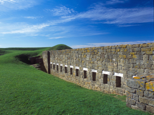
General view of Fort Beauséjour — Fort Cumberland, showing the footprint and extant ruins of the fort.
Photo: Parks Canada Agency / Agence Parcs Canada.
- Built
- 1750–1751
- Recognized
- 1920
- By
- Government of Canada
The register’s text, word for word
Description
Fort Beauséjour — Fort Cumberland National Historic Site of Canada is a star-shaped late 18th- and early 19th-century military fortification situated on the narrow neck of land between Nova Scotia and New Brunswick at the southwestern end of the Cumberland Ridge near Aulac, New Brunswick. The designation refers to the site of the fortification as well as Butte à Roger (a French observation post just east of the fortress area), Ile de la Vallière (Tonge's Island), Chipoudy Point, the site of a French redoubt at the river crossing at Pointe de Bute (Pont à Buot), and Inverma Farm (to the north on the Cumberland Ridge).
Heritage value
Fort Beauséjour — Fort Cumberland was designated a national historic site of Canada because:
- of the roles it played in two major 18th-century conflicts, the Anglo-French rivalry of 1749-63 and the American Revolution of 1776-83,
- known as Beauséjour, the fort defended French interests in the Chignecto isthmus from 1751 until it was captured by a force of British and New Englanders during a siege in 1755,
- known later as Fort Cumberland, the post with its British defenders repulsed an attack from sympathizers associated with the American Revolution in 1776, which contributed to keeping Nova Scotia out of the revolution.
The heritage value of Fort Beauséjour — Fort Cumberland National Historic Site of Canada lies in its historical role as illustrated by the extensive cultural landscape encompassing both the fortress and its defensive works, as well as five outlying properties associated with it (Butte à Roger, Ile de la Vallière, Chipoudy Point, the redoubt at Pont à Buot, Inverma Farm). Construction of Fort Beauséjour was begun in 1751 by the French and completed by the British after they captured it in 1755 and renamed it Fort Cumberland. The fort closed in 1835. Parks Canada now administers Fort Beauséjour — Fort Cumberland as a national historic site of Canada open to the public.
SourceHistoric Sites and Monuments Board of Canada, Minutes, May 1921, June 1984; Commemorative Integrity Statement, November 2000.
Character‑defining elements
Key elements of the cultural landscape comprising the Fort Beauséjour — Fort Cumberland fortress, its defensive works, and the outlying properties of Butte à Roger, Ile de la Vallière, Chipoudy Point, the redoubt at Pont à Buot, Inverma Farm, include:
- their strategic placement and settings individually and in relation to one another;
- the high, commanding location of the fortress site on the west end of the ridge,
- all remnants of British, French, Acadian, Mi'kmaq and New England occupation in the 1743-1835 period, above and below ground, including artifacts now held by Parks Canada;
- the footprint and extant ruins of the Vauban style fort with its pentagonal form and projecting bastions in their design, extent and materials;
- the historic location, layout, form and mass, and materials of the remains of the bastions, adjoining curtain walls, the ditch, spur and encampment;
- the historic location, layout, form and mass, and materials of the remains of all other structures associated with the primary value of the complex (i.e. at Butte à Roger, Ile de la Vallière, Chipoudy Point, the redoubt at Pont à Buot, Inverma Farm);
- surviving evidence of the appearance (form, fabric and finish) of facilities from the 1751-1835 period in all of these locations including those below ground (such as the French timber casemates, and French powder magazine);
- evidence of 1751-1835 functional design showing the quality, functional placement and materials of specific components (such as the cut stone loop-holes of the stone curtain, and the original components of the French well casemate walls, although many other examples exist) and of entire types of facilities (i.e. the parade ground, British officers' barracks, entrance, guardhouse, British men's barracks and other Level 1 facilities);
- the unobstructed viewplanes from the fortification to the Chignecto Basin, to dyked marshlands along the Missaguash River, and the Aulac River, to former French observation posts at Ile de la Vallière and Butte à Roger, inland and above to the height of the Cumberland Ridge;
- viewplanes from associated sites to the fortress proper;
- visibility of the fortress from both land and water.
End of the register’s text
Location
111 Fort Beauséjour Road, Aulac, New Brunswick, E4L, Canada
45.86448° N, 64.29154° W
Get directions (opens in a new tab)Being on the register doesn’t make a place open to visitors. Many are private homes or businesses; please view them from the street.

Loading map…
Nearby
All 4 places in Aulac Picnic Shelter / Pavilion450 m · 1920
 Picnic Shelter / Lodge450 m · 1920
 Visitor Centre / Museum1 km · 1936
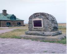 Tonge's Island National Historic Site of Canada1.7 km · Sackville · 1676
 Beaubassin National Historic Site of Canada2.7 km · Fort Lawrence
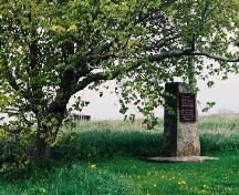 Fort Lawrence National Historic Site of Canada3 km · Cumberland · 1750
Similar places
Places whose register descriptions are closest to this one.
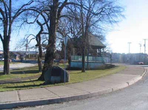 Fort Charnisay National Historic Site of CanadaSaint John, New Brunswick
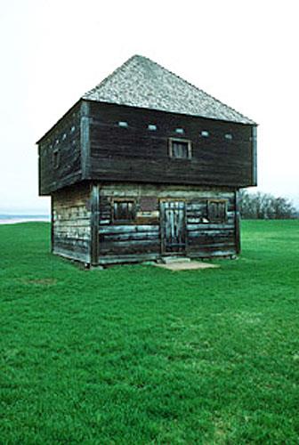 Fort Edward National Historic Site of CanadaWindsor, Nova Scotia
 Fort Nashwaak (Naxoat) National Historic Site of CanadaFredericton, New Brunswick
 Fortress of Louisbourg National Historic Site of CanadaLouisbourg, Nova Scotia
 Fredericton Military Compound National Historic Site of CanadaFredericton, New Brunswick
 Fort Howe National Historic Site of CanadaSaint John, New Brunswick
From the Canadian Register of Historic Places, as last updated on December 12, 2025. The register’s text is shown word for word.