CORONATION BOUNDARY MARKER
Description
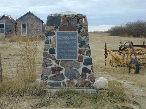
The Coronation Boundary Marker is a commemorative cairn situated roughly ten kilometres south of the town of Coronation.
Heritage Value
The heritage value of the Coronation Boundary Marker lies in its commemoration of the surveying of territorial boundaries in the North-West Territories prior to the creation of the Province of Alberta.
On the 8th of May 1882, a Dominion Order-in-Council provided that "a portion of the North-West Territories should be divided into provisional districts and their boundaries defined." The Coronation Boundary Marker is situated at the axis of three of these districts. The District of Alberta lay to the west, the district of Saskatchewan lay to the northeast, and the district of Assiniboia lay to the southeast. The District of Athabaska to the north did not have a common boundary at this point. In 1905, the Provinces of Alberta and Saskatchewan were created, incorporating most of the lands of the four old districts. A cairn was installed at this site in 1959 to commemorate the creation of these four new districts in the North-West Territories.
Source: Alberta Culture and Community Spirit, Historic Resources Management Branch (File: Des. 585)
Character-Defining Elements
The character-defining elements of the Coronation Boundary Marker include such features as:
- mass, form, and scale;
- plaques;
- location.
Gallery
1 imageLocation
Loading map...
Similar Places
Heritage sites with similar characteristics