Municipal Register of Local Historic Places
Burns Mill Site
Rexton, New Brunswick
Also known as Burns Saw Mill, Scierie Burns, McWilliam's Mill
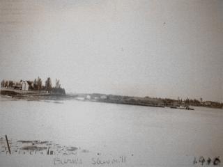
Burns Mill with a large sawdust pile and boat.
Photo: Village of Rexton
- Recognized
- 2006
- By
- Local government
The register’s text, word for word
Description
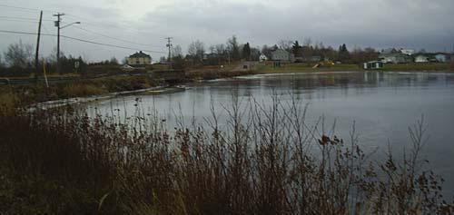
The Burns Mill Site is a vacant low lying point of land with exposed remnants of cribbing and wooden slabs. It is located on the south side of the Richibucto River's edge, above the Rexton Bridge in the Village of Rexton.
Heritage value
The Burns Mill Site is designated a Local Historic Place for its association with the activities of the former Burns Mill during a time when landowners could hold water rights on the Richibucto River.
In the 1800's, the river was the easiest and most efficient way to move logs by way of floating them and containing them in a boom. The Richibucto River had several locations where floating logs were held before entering the mills, including the Burns Mill. Burns Mill extended to the channel of the river and in the calm waters beside the mill the booms of logs were stored. This water, considered property of the mill, was transferred and bequeathed as such. Thomas Burns who built the mill on this site in the late 1800's had both river rights and booming privileges which he bequeathed to his son in 1916. To his daughter, he left the income generated by the mill for the one year of 1916. The property's stategic location next to the river is representative of the necessary link between logging and the water. Evidence of mill activity still exists in the remnants of the cribbing along the river's edge, as well as the undisturbed collection of log wedging slabs located along the riverbank and at the site of the mill itself.
SourceVillage of Rexton Local Historic Places File # 2006-6
Character‑defining elements
The character defining elements that describe the Burns Mill Site include:
- location where the river is deep enough for ships and tugboats to travel;
- location near a quiet creek where logs could be floated;
- remnant cribbing;
- slabs from the logs wedging in the river bank and at the site of the mill.
End of the register’s text
Location
44 Sunset Drive, Rexton, New Brunswick, E4W, Canada
46.64137° N, 64.87811° W
Get directions (opens in a new tab)Being on the register doesn’t make a place open to visitors. Many are private homes or businesses; please view them from the street.

Loading map…
Nearby
All 23 places in Rexton

Similar places
Places whose register descriptions are closest to this one.
From the Canadian Register of Historic Places, as last updated on December 12, 2025. The register’s text is shown word for word.