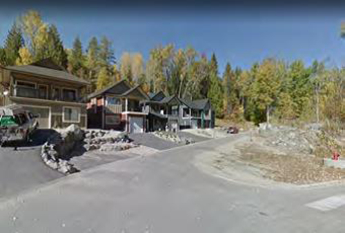
Redstone Neighbourhood
Photo: City of Rossland
- Built
- 2000–2020
- Recognized
- 2020
- By
- Local government
The register’s text, word for word
Description
The Redstone neighbourhood is located in the southeast quadrant of the City of Rossland, BC. It is bounded in the north by Highway 3B and diagonally to Princess Street. The west boundary is Queen Street and the south and east border is the City of Rossland boundary.
Heritage value
The Redstone neighbourhood has social value primarily as a quiet and contemporary suburb of Rossland, with single detached houses built in the 2000s on sizable properties. Older properties not located in the new subdivision are valued by their residents for their quiet isolation. Redstone residents, in general, find the neighbourhood valuable for its proximity to forest trails and the golf course. The golf course was built in 1927.
Character‑defining elements
Character-defining elements may be found in its:
- Recent houses in contemporary styles on large properties.
- Golf Course.
- Forest hillside and valley settings.
- Trailheads to forest walks, often following historic rail or road alignments.
End of the register’s text
Location
Rossland, British Columbia, Canada
49.06771° N, 117.78754° W
Get directions (opens in a new tab)Being on the register doesn’t make a place open to visitors. Many are private homes or businesses; please view them from the street.

Loading map…
Similar places
Places whose register descriptions are closest to this one.
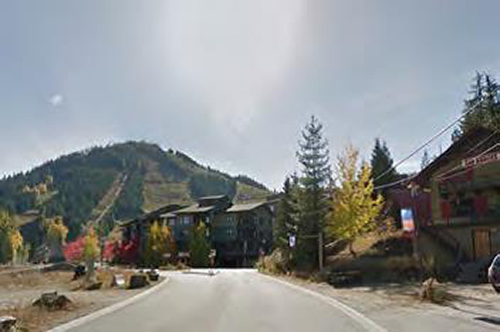 Red Mountain NeighbourhoodRossland, British Columbia
 Upper Rossland NeighbourhoodRossland, British Columbia
 Stone BlockRossland, British Columbia
 Lower Rossland NeighbourhoodRossland, British Columbia
 Happy Valley NeighbourhoodRossland, British Columbia
 Downtown Rossland NeighbourhoodRossland, British Columbia
From the Canadian Register of Historic Places, as last updated on December 12, 2025. The register’s text is shown word for word.