Municipal Heritage Designation (Part IV)
Merton-Mount Pleasant Cemetery
Town of Oakville, Ontario
Also known as 2411 North Service Road West
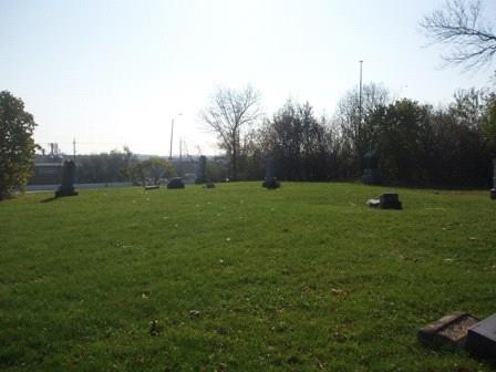
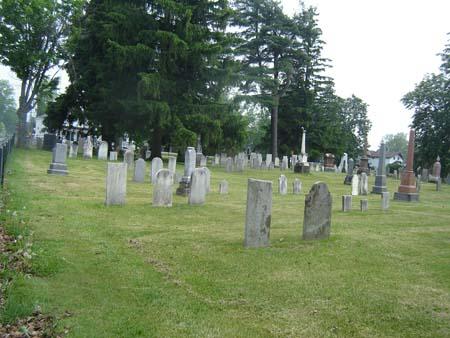
Of note are the individual gravestones.
Photo: Martha Fallis, 2008.
- Built
- 1880
- Recognized
- 1993
- By
- Local government
The register’s text, word for word
Description
Merton-Mount Pleasant Cemetery is located across from the Deerfield Golf Club on the south side of North Service Road West, east of Bronte Road in the Town of Oakville.
The property was designated by the Town of Oakville in 1993 for its heritage value under Part IV of the Ontario Heritage Act (By-law 1993-20).
Heritage value
Merton-Mount Pleasant Cemetery is associated with Oakville's earliest pioneers. The cemetery was established in 1880 on the grounds of the Methodist-Episcopal Mount Pleasant Church. The first burial occurred on this site in 1886.
In the early 20th century, the congregation of the church began to decline and in 1918 the church was closed. The church was later demolished, but the cemetery remained out of respect for those interred within the grounds. The property is one of the last remnants of the old Hamlet of Merton.
Merton-Mount Pleasant Cemetery is a good representation of 19th century cemetery design. It is characterised by a naturalistic setting to attract and comfort the living, the use of markers and monuments to perpetuate the memory of individuals and a park-like layout for public use. True to the original plan, gravesites are placed with separate individual markers.
SourceTown of Oakville, By-law 1993-20.
Character‑defining elements
Character defining elements that contribute to the heritage value of Merton-Mount Pleasant Cemetery include the:
- the range of size and sophistication of markers and monuments, from modest to elaborate
- church date stone along North Service Road West
- layout including mature trees along the property line
- monuments
- individual grave markers with their surviving inscriptions
End of the register’s text
Location
2411, North Service, Town of Oakville, Ontario, Canada
43.41700° N, 79.73367° W
Get directions (opens in a new tab)Being on the register doesn’t make a place open to visitors. Many are private homes or businesses; please view them from the street.

Loading map…
Similar places
Places whose register descriptions are closest to this one.
From the Canadian Register of Historic Places, as last updated on December 12, 2025. The register’s text is shown word for word.