Heritage Lighthouse
Île-du-Havre-aux-Maisons Lighthouse
Île du Havre-aux-Maisons, Quebec
Also known as Cape Alright Lighttower, Phare du cap Alright, Echouerie de la Pointe-Basse Lighttower
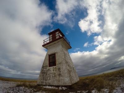
Corner view of the lighthouse showing its wooden square-tapered tower that measures 8,5 metres
Photo: Agence Parcs Canada | Parks Canada Agency, Luc Miousse, 2015.
- Built
- 1928
- Recognized
- 2015
- By
- Government of Canada
The register’s text, word for word
Description
The Île-du-Havre-aux-Maisons Lighthouse, also known as Cape Alright Lighthouse, is a wooden square tapered tower that measures 8, 5 metres (28feet). Built in 1928, it stands atop 20-metre-high red sand cliffs on Cape Alright at the eastern extremity of Île-du-Havre-aux-Maisons. It warns off its shore and around the Les Îles-de-la-Madeleine.
Heritage value
The Île-du-Havre-aux-Maisons Lighthouse is a heritage lighthouse because of its historical, architectural, and community values.
Heritage values
The Île-du-Havre-aux-Maisons Lighthouse is a very good example of the efforts of the Canadian government to improve aids to navigation in the maritime corridor of the Gulf of St. Lawrence, particularly around Les Îles-de-la-Madeleine, which has been notoriously known for its dangerous waters that have caused more than 700 shipwrecks.
Since its establishment in 1928, the Île-du-Havre-aux-Maisons Lighthouse has served the fishing industry, which is the main economy of Les Îles-de-la-Madeleine. The local fishery’s success has always been dependant on the lighthouses built on Les Îles-de-la-Madeleine.
Architectural values
The short, broad base design of the Île-du-Havre-aux-Maisons Lighthouse is very well suited to the maritime conditions of Les Îles-de-la-Madeleine. The lighthouse is well built using durable local materials and high quality craftsmanship, and has withstood the fierce weather conditions on the island. It also reflects the popular design favoured by the Department of Marine and Fisheries from the late-19th century onwards since wooden square-tapered lighthouses were economical to build, durable, and able to withstand heavy winds due to their low centre of gravity.
Community values
Standing atop 20-metre-high cliffs and surrounded by a vast expanse of grassy meadows, the Île-du-Havre-aux-Maisons Lighthouse reinforces the maritime character of the area. With only a round-topped hill and a scattering of houses as its backdrop, the lighthouse is highly visible from land and water.
The Île-du-Havre-aux-Maisons Lighthouse is a symbol of the Municipalité des Îles-de-la-Madeleine. The lighthouse serves as a strong reminder of the area’s cultural, economic and maritime history. It is highly valued by the local community as it is a significant navigational aid fro the area and a popular destination for walking.
Related buildings
No related building.
Character‑defining elements
The following character-defining elements of the Île-du-Havre-aux-Maisons Lighthouse should be respected:
- its location atop a cliff on the eastern tip of Île-du-Havre-aux-Maisons;
- its current, as-built form and proportions, based on the standard design of wooden squared-tapered towers;
- its square, wooden frame structure with tapered sides rising from a square base;
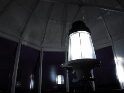
- its wood-framed lantern room topped by a pyramidal roof with vent, and the door leading to the lantern;
- its flared cornice that supports a square gallery;
- its simple iron railing surrounding the gallery;
- its single six-paned window that projects from the façade;
- its sole entry door with its plain shed dormer;
- its wooden exterior siding;
- its traditional red and white exterior colour scheme consisting of white for the tower, gallery, and lantern, and red for the gallery railing, roof ventilator, lantern door, window frames and door pediment; and,
- its visual prominence in relation to the water and landscape.
End of the register’s text
Location
De la Pointe-Basse Road, Île du Havre-aux-Maisons, Quebec, Canada
47.39089° N, 61.77350° W
Get directions (opens in a new tab)Being on the register doesn’t make a place open to visitors. Many are private homes or businesses; please view them from the street.

Loading map…
Nearby
 Phare du Cap-Alrightwithin 100 m · Les Îles-de-la-Madeleine · 1928
 École Saint-Joseph2.1 km · Les Îles-de-la-Madeleine · 1906
 Vieux couvent de Havre-aux-Maisons3.4 km · Les Îles-de-la-Madeleine · 1914
 Presbytère du Havre-aux-Maisons3.5 km · Les Îles-de-la-Madeleine
 Église de Saint-Pierre-de-La Vernière10 km · Les Îles-de-la-Madeleine · 1872
 Église All Saints14 km · Les Îles-de-la-Madeleine · 1948
Similar places
Places whose register descriptions are closest to this one.
 Cap de la Madeleine LighthouseSainte-Madeleine-de-la-Rivière-Madeleine, Quebec
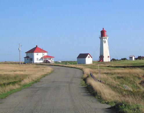 Phare de l'Anse-à-la-CabaneLes Îles-de-la-Madeleine, Quebec
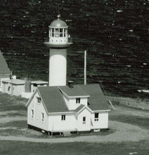 LighthouseCap-de-la-Madeleine, Quebec
 Cap au Saumon LighthouseLa Malbaie, Quebec
 Cap de la Tête au Chien LighthouseSaint-Siméon, Quebec
 Île Verte LighthouseNotre-Dame-des-Sept-Douleurs, Quebec
From the Canadian Register of Historic Places, as last updated on December 12, 2025. The register’s text is shown word for word.