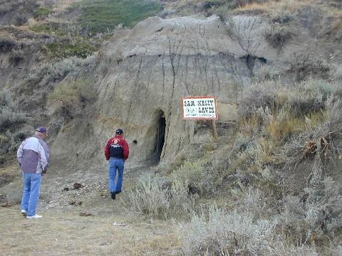
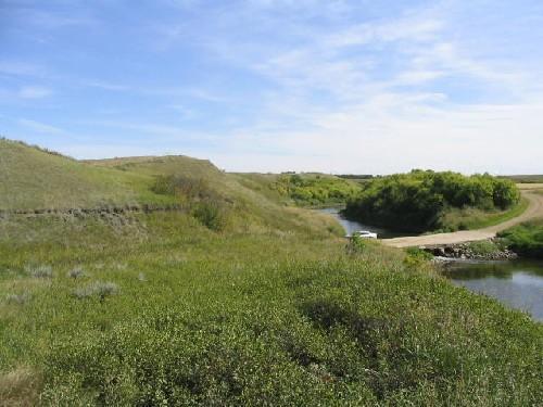
Photo: Government of Saskatchewan, Carlos Germann, 2003.
- Reconnaissance
- 1999
- Par
- Administrations locales (Sask.)
Le texte du répertoire, mot pour mot
Description
The Sam Kelly Sites is a Municipal Heritage Property consisting of 256 hectares of land located in a branch of the Big Muddy Valley near the United States border. The property contains at least nine archaeological sites, including stone rings and effigies, caves and homestead remains.
Valeur patrimoniale
The heritage value of the Sam Kelly sites lies in their association with important local and regional historic themes. The stone rings and effigies reveal information regarding both everyday and ceremonial aspects of precontact First Nations culture. First Nations still hold these sites in high regard for their spiritual significance and as symbols of cultural continuity.
Other sites on the property have associations with individuals who embody the mythology of the western frontier. Around the turn of the twentieth century, outlaws such as Sam Kelly, Dutch Henry, and the Nelson Jones gang reportedly used the valley's caves to hide out from American authorities. The homestead remains are related to Monty Montana, a singing cowboy, trick roper and occasional movie actor renowned for appearing in sixty Tournament of Roses parades.
The Sam Kelly sites are also valued for their contribution to the local community’s sense of time and place. Residents take pride in the distinctive character of their district, which derives in large part from the history represented by these sites.
Source:
Rural Municipality of Happy Valley No. 10 Bylaw No. 1-99.
Éléments caractéristiques
The heritage value of the Sam Kelly Sites resides in the following character-defining elements:
-all of the property’s archaeological objects and features, especially those in their existing locations, such as stone rings, cairns and effigies, cellar depressions, caves and artifacts;
-the near pristine natural setting which evokes a sense of the past;
-use of the site by First Nations for ceremonial purposes;
-use of the site by community residents for educational, leisure and tourism purposes.
Fin du texte du répertoire
Emplacement
49.00690° N, 105.00053° W
Itinéraire (s’ouvre dans un nouvel onglet)L’inscription au répertoire ne rend pas un lieu accessible au public. Beaucoup sont des résidences ou des commerces privés; admirez-les depuis la rue.

Chargement de la carte…
À proximité
Les 3 lieux de Happy Valley RM 10
Lieux semblables
Les lieux dont la description du répertoire se rapproche le plus de celle-ci.
 Smith Barn SiteHappyland RM 231, Saskatchewan
 Herschel Petroglyph/Tipi Ring SiteMountain View RM 318, Saskatchewan
 Saamis SiteMedicine Hat, Alberta
 Chimney Coulee SiteArlington RM 79, Saskatchewan
 Wildhorse Creek Historic SiteEast Kootenay, Colombie Britannique
 Wamsley Bridge SiteGravelbourg RM 104, Saskatchewan
Tiré du Répertoire canadien des lieux patrimoniaux, dans sa dernière mise à jour du 12 décembre 2025. Le texte du répertoire est reproduit mot pour mot.