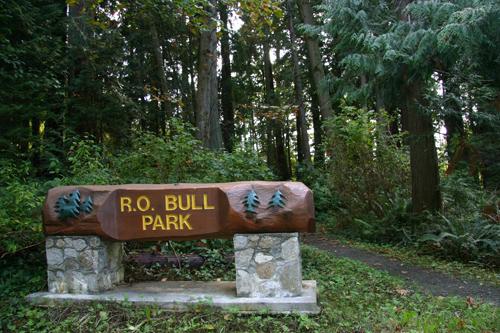
Photo: District of North Saanich, 2007
- Reconnaissance
- 2008
- Par
- Administrations locales (C.-B.)
Le texte du répertoire, mot pour mot
Description
R.O. Bull Memorial Park is a municipally-owned park located on a sloping forested site near the west end of Wain Road in the Deep Cove neighbourhood of North Saanich. The park includes a grove of mature Douglas Fir and Western Red Cedar trees that is among the last remaining examples of old growth forest on the Saanich Peninsula.
Valeur patrimoniale
R.O. Bull Memorial Park is significant as a rare surviving example of the first growth forests that were once common in North Saanich, as in other parts of the Saanich Peninsula. This remaining stand reveals the maturity and scale of the area's original vegetation and illustrates the landscape of pre-European settlement. The Douglas Fir and Western Red Cedar trees on this site are noted for their exceptional size and age, and are significant living examples of North Saanich’s natural heritage. R.O. Bull Park demonstrates North Saanich’s commitment to recognizing and preserving its natural heritage.
R.O. Bull Memorial Park is also significant for its association with prominent community leader and honourary citizen of Victoria, Roland Osborne Bull, for whom the park was named. Following a business career in Toronto, Bull retired to Vancouver Island in 1957 and founded the Victoria Boys’ Club in 1960. After his death, Roland Bull's commitment to the community and his love of trees were commemorated through the acquisition of land for this park in 1977. The Nature Conservancy of Canada acquired the property with funds donated by Bull's friends and relatives, other citizens, corporations and societies such as the Victoria Horticultural Society. It was later transferred to the District of North Saanich to be maintained as a public park.
SourcePlanning Department, District of North Saanich
Éléments caractéristiques
Key elements that define the heritage character of the R.O. Bull Memorial Park include its:
- location near the west end of Wain Road in the Deep Cove neighbourhood
- remnants of old growth forest, including a full canopy of Western Red Cedars and Douglas Firs of notable size and age
Fin du texte du répertoire
Emplacement
48.67666° N, 123.47965° W
Itinéraire (s’ouvre dans un nouvel onglet)L’inscription au répertoire ne rend pas un lieu accessible au public. Beaucoup sont des résidences ou des commerces privés; admirez-les depuis la rue.

Chargement de la carte…
À proximité
Les 12 lieux de North Saanich
Lieux semblables
Les lieux dont la description du répertoire se rapproche le plus de celle-ci.
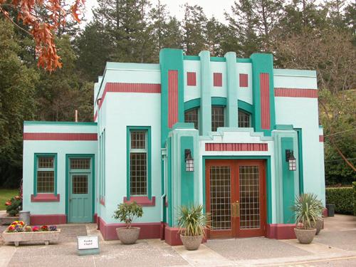 Royal Oak Burial ParkSaanich, Colombie Britannique
 Robert Service Memorial ParkCowichan Bay, Colombie Britannique
 Lillian Hoffar ParkNorth Saanich, Colombie Britannique
- Rathtrevor Beach Provincial ParkParksville, Colombie Britannique
 Victoria ParkNorth Vancouver, Colombie Britannique
 The Rock ParkVernon, Colombie Britannique
Tiré du Répertoire canadien des lieux patrimoniaux, dans sa dernière mise à jour du 12 décembre 2025. Le texte du répertoire est reproduit mot pour mot.