Bien patrimonial municipal
Cenotaph Site
Waldron, Saskatchewan
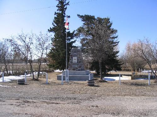
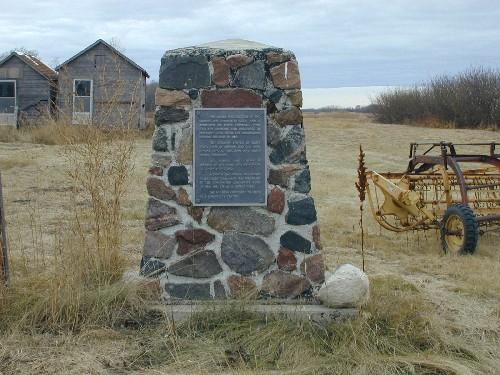
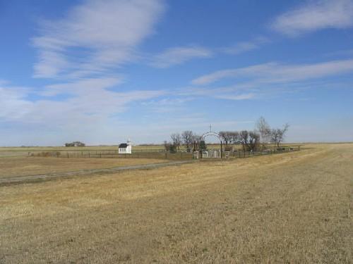
Photo: Government of Saskatchewan, Brett Quiring, 2007.
- Construction
- 1930
- Reconnaissance
- 2005
- Par
- Administrations locales (Sask.)
Le texte du répertoire, mot pour mot
Description
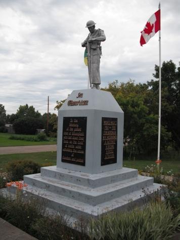
The Cenotaph Site is a Municipal Heritage Property located at the end of Main Street in the Village of Waldron. The property features a fieldstone cairn mounted on a cement base erected in 1930, surrounded by a small park.
Valeur patrimoniale
The heritage value of the Cenotaph Site lies in its commemoration of the sacrifice of the Waldron and District war veterans. The cairn was constructed in 1930 to commemorate the veterans of the First World War. However, after 1945, the names of veterans of the Second World War were added to the monument. The cairn is surrounded by a small park planted with a variety of trees and shrubs. The park space sets the Cenotaph Site apart from surrounding properties and contributes to the visitor’s ability to reflect on the contribution of the area’s veterans.
The heritage value of the property also lies in its architecture and construction material. The cairn was constructed of fieldstone shaped into a small obelisk mounted on a stepped concrete foundation. The use of fieldstone, and its unique shape, contributes to its status as a local landmark.
Source:
Village of Waldron Bylaw 06/2005.
Éléments caractéristiques
The heritage value of the Cenotaph Site resides in the following character-defining elements:
-those elements that reflect the property’s commemoration of the district’s veterans of the First and Second World Wars, including the “CEF” and “1915-1918” inscriptions on the front façade and the stone plaque listing veterans of the two world wars, flag pole, and tree and shrub plantings around the monument;
-those elements that reflect the property’s architecture and construction material, including the cairn’s use of fieldstone shaped into an obelisk and the two-step concrete foundation.
Fin du texte du répertoire
Emplacement
50.85187° N, 102.51387° W
Itinéraire (s’ouvre dans un nouvel onglet)L’inscription au répertoire ne rend pas un lieu accessible au public. Beaucoup sont des résidences ou des commerces privés; admirez-les depuis la rue.

Chargement de la carte…
À proximité
 Ukrainian Greek Catholic Church of St. George21 km · Melville · 1939
 Intercession of St. Mary Ukrainian Greek Orthodox Church22 km · Melville · 1928
 Kristiania Lutheran Church22 km · Atwater · 1920
 First Union Church22 km · Melville · 1919
 Melville Railway Museum22 km · Melville · 1911
 Gare ferroviaire Canadien national22 km · Melville · 1908
Lieux semblables
Les lieux dont la description du répertoire se rapproche le plus de celle-ci.
Tiré du Répertoire canadien des lieux patrimoniaux, dans sa dernière mise à jour du 12 décembre 2025. Le texte du répertoire est reproduit mot pour mot.