Bien inscrit au répertoire provincial
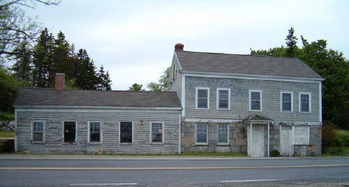
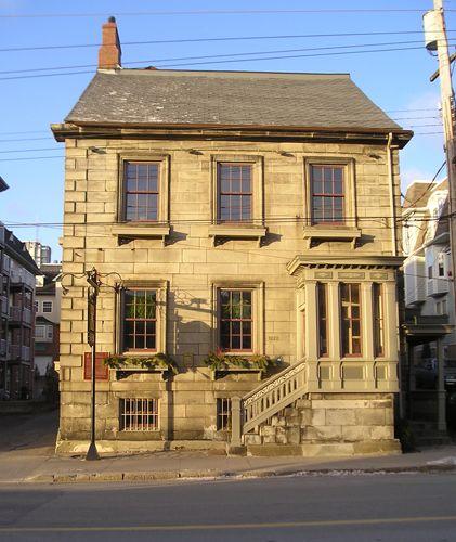
Cannon House
Diligent River, Nouvelle Ecosse
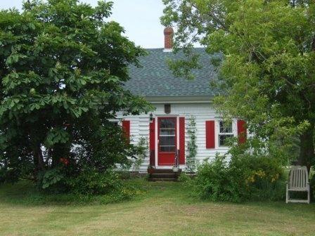
Photo: Heritage Division, NS Dept. of Tourism, Culture and Heritage, 2007
- Reconnaissance
- 1989
- Par
- Province de la Nouvelle-Écosse
Le texte du répertoire, mot pour mot
Description
Cannon House is a turn of the nineteenth-century, one-and-one-half-storey wood frame house located on Highway 209, in Diligent River, Nova Scotia. The building and property are included in the provincial designation.
Valeur patrimoniale
Cannon House is valued for its architecture and for its associations with the Cannon family.
Thought to have been constructed circa 1808, homes of this age are uncommon along the Parrsboro shore. Its finely executed exterior detail especially that of the crisply defined cornice, is also uncommon in the area. It has a simple three-bay façade, return eaves and simple window and door surrounds.
The Cannon family has a significant tie to the history of Nova Scotia. The first members arrived from England with Governor Edward Cornwallis to found Halifax in 1749. This parcel of land was originally owned by Mary Cannon who was the mistress Joseph Frederick Wallett Desbarres, former aide-de-camp of General Wolf, lieutenant governor of Cape Breton and renowned cartographer. Cannon became his land agent and became a landowner herself. In 1794 Cannon purchased this land from Loyalist Eleazar Taylor using monies she received as child support from DesBarres.
John Cannon settled on this land, initially probably as a tenant of Mary, who was either his sister or cousin. Here he initially built a log house and later purchased the land. It was after his marriage in 1808 that he likely built the present structure. Cannon House passed to John's son Isaac, a sea captain, and is today in the ownership of his great-granddaughter, which means the house has remained in one family for two-hundred years.
SourceProvincial Heritage Program property file no. 106
Éléments caractéristiques
Character-defining elements of Cannon House include:
- one-and-a-half storey wooden construction;
- detailed window and door surrounds;
- cornice;
- three bay front façade;
- central chimney;
-single sash, six-over-six windows;
- wood shingle cladding;
- location in agricultural setting facing the Minas Basin.
Fin du texte du répertoire
Emplacement
45.41274° N, 64.45747° W
Itinéraire (s’ouvre dans un nouvel onglet)L’inscription au répertoire ne rend pas un lieu accessible au public. Beaucoup sont des résidences ou des commerces privés; admirez-les depuis la rue.

Chargement de la carte…
À proximité
Lieux semblables
Les lieux dont la description du répertoire se rapproche le plus de celle-ci.
Tiré du Répertoire canadien des lieux patrimoniaux, dans sa dernière mise à jour du 12 décembre 2025. Le texte du répertoire est reproduit mot pour mot.