
Photo: Fedyk, 2009
- Construction
- 1930
- Reconnaissance
- 2008
- Par
- Administrations locales (Sask.)
Le texte du répertoire, mot pour mot
Description
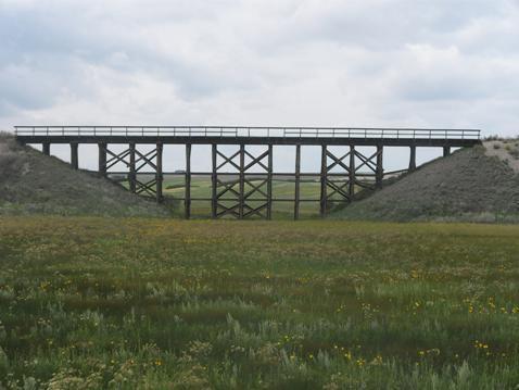
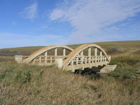
The Canadian National Railway Bridge is a Municipal Heritage Property located in the Rural Municipality of Heart’s Hill No. 352, approximately 30 km northwest of the Town of Luseland. The property features a 1930 wooden truss railway bridge spanning a small gully.
Valeur patrimoniale
The heritage value of the Canadian National Railway Bridge lies in its role as part of the CNR Unity to Bodo branch line. The bridge is the only significant built structure that remains along the railway right-of-way. The bridge was constructed along with the branch line in 1930, and served the area until 1993, when the line was abandoned and the tracks removed. During the period of its operation, farmers in the Rural Municipality of Heart’s Hill delivered grain to elevators in communities along the branch line, making it a crucial element of the area’s agricultural economy.
The heritage value of the CNR Bridge also lies in its architecture and integrity. The bridge is an example of a simple wooden truss bridge typically used by the railway to cross small gullies and other gaps along the right-of-way. Today, the structure features its original wood trusses, piers, pier abutments, timber bents and stringer spans, and is a popular local landmark, particularly with photographers and painters.
Source:
Rural Municipality of Heart’s Hill No. 352 Bylaw No. 2-08.
Éléments caractéristiques
The heritage value of the Canadian National Railway Bridge resides in the following character-defining elements:
-those elements that reflect the bridge’s role as part of the Unity to Bobo CNR branch line, and its landmark status, such as its position on its original location;
-those elements that reflect the property’s truss bridge historic architecture, such as its trusses, piers, pier abutments, timber bents and stringer spans.
Fin du texte du répertoire
Emplacement
52.06058° N, 109.48239° W
Itinéraire (s’ouvre dans un nouvel onglet)L’inscription au répertoire ne rend pas un lieu accessible au public. Beaucoup sont des résidences ou des commerces privés; admirez-les depuis la rue.

À proximité
Lieux semblables
Les lieux dont la description du répertoire se rapproche le plus de celle-ci.
Tiré du Répertoire canadien des lieux patrimoniaux, dans sa dernière mise à jour du 12 décembre 2025. Le texte du répertoire est reproduit mot pour mot.