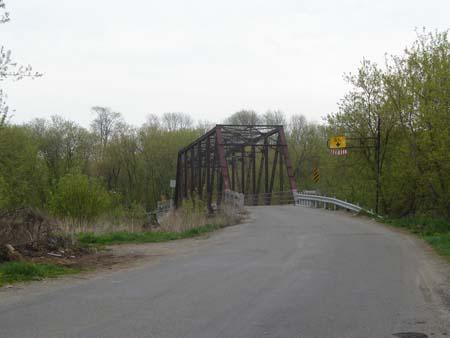
Photo: Kayla Jonas, 2007.
- Construction
- 1916
- Reconnaissance
- 2003
- Par
- Administrations locales (Ont.)
Le texte du répertoire, mot pour mot
Description
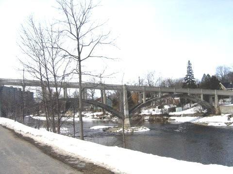
The Black Bridge is located on Black Bridge Road, between Guelph Avenue North and Townline Road, in the City of Cambridge. Black Bridge is a single-lane, pin-jointed, steel truss bridge, which was constructed in 1916.
The property was designated, by the City of Cambridge in 2003, for its cultural value or interest ,under Part IV of the Ontario Heritage Act (By-law 16-03).
Valeur patrimoniale
Spanning the Speed River, a major tributary of the Grand River, a Canadian Heritage River, the Black Bridge contributes to the scenic rural landscape on the border of Puslinch (Guelph) and Cambridge.
The Black Bridge was constructed in 1916, but there is evidence of a wooden bridge on this site as early as 1910. Historically, Black Bridge Road was called Block Line and was an important boundary in Waterloo County. It divided Wilson's Upper Block from Wilson's Lower Block, and served as a point of reference on early maps, dating back to 1805.
The Black Bridge was built in a design typical of the era. It is a single-lane, pin-jointed, steel truss bridge and, despite extensive repairs, in 1931 and 1996, has retained its original form. It is the only remaining steel bridge of its kind in the City of Cambridge.
SourceCity of Cambridge By-Law 16-03; Spanning the Generations: Heritage Assessment (Black Bridge Road Bridge), 1999.
Éléments caractéristiques
Character defining elements that contribute to the heritage value of the Black Bridge include its:
- single-lane construction
- pin-joints
- steel truss configuration
- location on Black Bridge Road, spanning the Speed River
- views to the bridge from both banks and the north and south Black Bridge Road approaches
- views from the bridge of the surrounding rural landscape
Fin du texte du répertoire
Emplacement
43.44947° N, 80.31164° W
Itinéraire (s’ouvre dans un nouvel onglet)L’inscription au répertoire ne rend pas un lieu accessible au public. Beaucoup sont des résidences ou des commerces privés; admirez-les depuis la rue.

Chargement de la carte…
À proximité
Les 16 lieux de City of Cambridge
Lieux semblables
Les lieux dont la description du répertoire se rapproche le plus de celle-ci.
Tiré du Répertoire canadien des lieux patrimoniaux, dans sa dernière mise à jour du 12 décembre 2025. Le texte du répertoire est reproduit mot pour mot.