
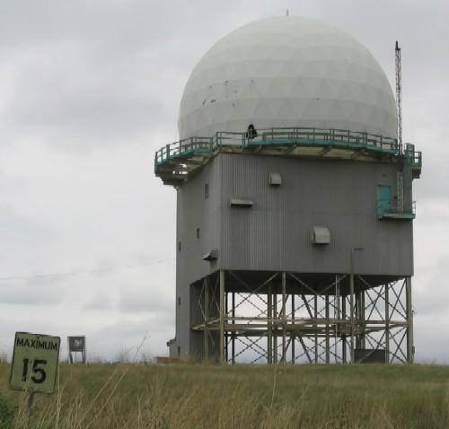
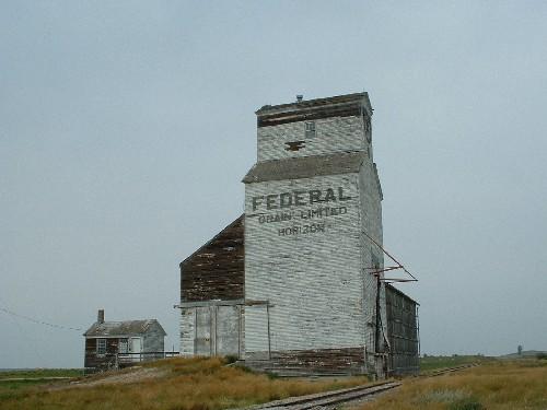
Photo: Government of Saskatchewan, Michael Thome, 2004
- Reconnaissance
- 2005
- Par
- Administrations locales (Sask.)
Le texte du répertoire, mot pour mot
Description
The Alsask Radar Dome is a 2.5 hectare parcel of land 400 meters north of the Village of Alsask within the Rural Municipality of Milton No. 292. The property features a metal-clad building with fibreglass dome and the remains of a roadway, all within a fenced enclosure.
Valeur patrimoniale
The heritage value of the Alsask Radar Dome resides in its association with the Pine Tree Line radar network. Undertaken in 1951, Pine Tree Line was a network of military radars which was designed to monitor Soviet activity in North American Airspace. This radar network was the first military program the Canadian and American government jointly pursued at the dawn of the cold war. The Alsask Radar was the last of several stations constructed on the Canadian Prairies during the late 1950s and early 1960s that were designed as upgrades to the Pine Tree Line.
The Heritage Value of the Alsask Radar Dome resides in its historic use. The 'golf ball' shaped fibreglass dome that surmounts a three storey tower is the last remnant of the military radar base operated on this site between 1961 and 1987. The fibreglass dome was designed to shield the radar array from inclement weather. The tower itself, raised on steel beams, is constructed out of corrugated metal and divided into two levels. The first floor housed the computer that analysed the radar signals and the second housed the command centre. During its lifetime, Canadian Forces Station Alsask was the economic and social centre of the region.
Source:
Rural Municipality of Milton No. 292 Bylaw No. 2/2005.
Éléments caractéristiques
The heritage value of Alsask Radar Dome resides in the following character defining elements:
-those elements that reflect the building's architecture, such as the shape and massing of the radar tower and dome, the size of the large rooms, the use of metal and fibreglass;
-those elements that reflect the radar’s historic use such as the remains of the radar array, the road and signage.
Fin du texte du répertoire
Emplacement
51.39209° N, 110.00605° W
Itinéraire (s’ouvre dans un nouvel onglet)L’inscription au répertoire ne rend pas un lieu accessible au public. Beaucoup sont des résidences ou des commerces privés; admirez-les depuis la rue.
À proximité

Lieux semblables
Les lieux dont la description du répertoire se rapproche le plus de celle-ci.
Tiré du Répertoire canadien des lieux patrimoniaux, dans sa dernière mise à jour du 12 décembre 2025. Le texte du répertoire est reproduit mot pour mot.