National Historic Site of Canada
Bloody Falls National Historic Site of Canada
Kugluktuk, Nunavut
Also known as Bloody Falls
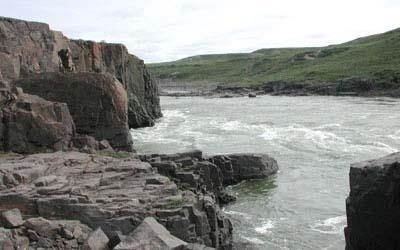
General view of Bloody Falls.
Photo: Agence Parcs Canada / Parks Canada Agency
- Recognized
- 1978
- By
- Government of Canada
The register’s text, word for word
Description
Bloody Falls National Historic Site of Canada is located within Kugluk / Bloody Falls Territorial Park, on the western shore of the Coppermine River, in Nunavut. The site encompasses pre-contact Aboriginal encampments set on river terraces along the broad, swift-flowing river. These encampments, of which there are no extant remains, were used as Aboriginal hunting and fishing stations for over three millennia, dating to 1700 B.C.E. Official recognition refers to the section of Kugluk / Bloody Falls Territorial Park that falls to the northwest of the Coppermine River.
Heritage value
Bloody Falls was designated as a national historic site of Canada in 1978 because:
- it was a traditional fishing site, also containing small caribou hunting stations, that record the presence of Pre-Dorset, Thule, First Nation and Inuit cultures over the past three millennia.
The archaeological remains found at Bloody Falls represent the occupations of several Aboriginal and Inuit peoples, spanning thousands of years. Material deposits were documented from the Thule occupation period circa. (1000-1500 B.C.E.). Beneath the bottom-most Thule layer of cultural deposits, Pre-Dorset (also referred to as the Arctic Small Tool Tradition) cultural material was discovered, dating from between 1700 and 1500 B.C.E. The location, away from the coast in the interior, served as a staging area for forays to hunt, fish and to obtain native copper.
In addition to the Thule houses, 10 pre-contact and historic Aboriginal encampments were recorded to the northern end of the site. These encampments yielded stone and bone artifacts from the pre-contact period, dating to 160 C.E. Also documented at the site were materials relating to the early historic occupation of Copper Inuit.
SourceHistoric Sites and Monuments Board of Canada, Minutes, 1978, 2009.
Character‑defining elements
Key elements that contribute to the heritage character of the site include:
- its location in the Kugluk / Bloody Falls Territorial Park, in Nunavut;
- its setting on river terraces along the western banks of the Coppermine River;
- the integrity of any surviving or as yet unidentified archaeological remains from Pre-Dorset, Thule, First Nation, and Inuit cultures found within the site, including cultural material, faunal remains and any vestiges from pre-contact occupation;
- viewscapes across the Coppermine River.
End of the register’s text
Location
Kugluktuk, Nunavut, Canada
67.74000° N, 115.36861° W
Get directions (opens in a new tab)Being on the register doesn’t make a place open to visitors. Many are private homes or businesses; please view them from the street.

Loading map…
Similar places
Places whose register descriptions are closest to this one.
 Kittigazuit Archaeological Sites National Historic Site of CanadaKittigazuit, Northwest Territories
 Bloody Creek National Historic Site of CanadaBridgetown, Nova Scotia
 Kitselas Canyon National Historic Site of CanadaKitselas, British Columbia
 Kiix?in Village and Fortress National Historic Site of CanadaBamfield, British Columbia
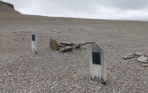 Beechey Island Sites National Historic Site of CanadaBeechey Island, Nunavut
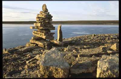 Igloolik Island Archaeological Sites National Historic Site of CanadaIgloolik Island, Nunavut
From the Canadian Register of Historic Places, as last updated on December 12, 2025. The register’s text is shown word for word.